UN/LOCODE hub · Greece
GRLIP

Lipsoí

37.2833°, 26.7667°
1
Transport functions

Transport Functions

Port
UN/LOCODE

Hub Profile

Region
81
GeoNames

Location

Location of GRLIP
Natural Earth 10m (public domain) · 81 · GRLIP · 37.28, 26.77GoogleOSMYandex

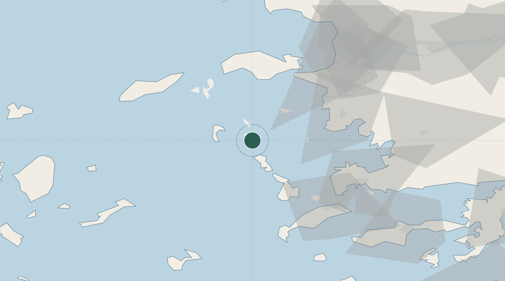
Nearby Logistics Neighbours

Cities
  1. 1Arkioi Dodekanissou12 km
  2. 2Leros12 km
  3. 3Agia Marina Lerou17 km
  4. 4Lakkion18 km
  5. 5Pátmos20 km
Nearest neighbours — logibook spatial index (haversine) over the source coordinates
Ports
  1. 1Lakki18 km
  2. 2Kalimnos42 km
  3. 3Pithagorion47 km
  4. 4Samos55 km
  5. 5Neon Karlovas58 km
Nearest neighbours — logibook spatial index (haversine) over the source coordinates
Airports
  1. 1Leros Airport11 km
  2. 2Kalymnos Airport39 km
  3. 3Samos Airport47 km
  4. 4Ikaria Airport58 km
  5. 5Kos International Airport "Ippokratis"62 km
Nearest neighbours — logibook spatial index (haversine) over the source coordinates
Trade Zones
  1. 1Aegean Free Zone121 km
  2. 2Tire Organized Industrial Zone124 km
  3. 3Izmir Ataturk Organized Industrial Zone136 km
  4. 4Izmir Free Zone149 km
  5. 5Manisa Organized Industrial Zone157 km
Nearest neighbours — logibook spatial index (haversine) over the source coordinates
DatabookThe Record of Consolidated Knowledge
Greece beyond logistics?
Browse databook

All Sources

LocationsUN/LOCODE
UN/LOCODE — free
Portsthe NGA World Port Index
Public domain (US gov)
AirportsOurAirports
Public domain
Trade Zonesthe World Bank SEZ database
CC BY 4.0
Trade ZonesOpen Zone Map
CC BY
← Greece locations