UN/LOCODE hub · Greece
GRAML

Agia Marina Lerou

37.1500°, 26.8500°
1
Transport functions

Transport Functions

Port
UN/LOCODE

Hub Profile

Region
81
GeoNames

Location

Location of GRAML
Natural Earth 10m (public domain) · 81 · GRAML · 37.15, 26.85GoogleOSMYandex

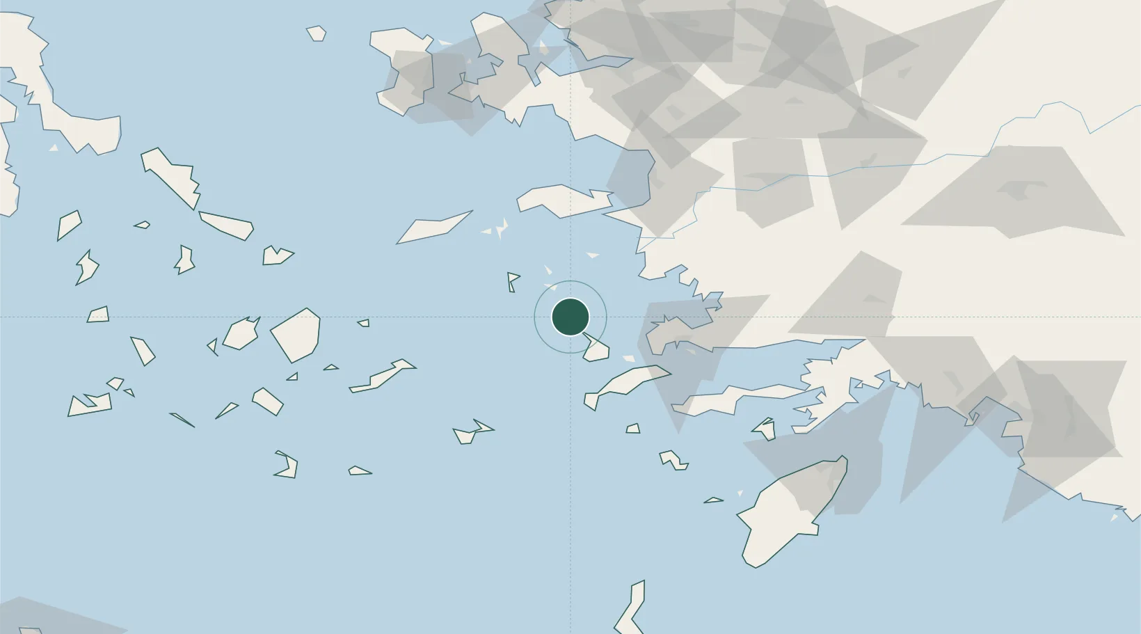
Nearby Logistics Neighbours

Cities
  1. 1Lakkion2 km
  2. 2Xirokampos Leros4 km
  3. 3Leros6 km
  4. 4Lipsoí17 km
  5. 5Myrties Kalymnou20 km
Nearest neighbours — logibook spatial index (haversine) over the source coordinates
Ports
  1. 1Lakki2 km
  2. 2Kalimnos25 km
  3. 3Limin Kos48 km
  4. 4Bodrum53 km
  5. 5Pithagorion60 km
Nearest neighbours — logibook spatial index (haversine) over the source coordinates
Airports
  1. 1Leros Airport6 km
  2. 2Kalymnos Airport22 km
  3. 3Kos International Airport "Ippokratis"45 km
  4. 4Samos Airport60 km
  5. 5Milas Bodrum International Airport73 km
Nearest neighbours — logibook spatial index (haversine) over the source coordinates
Trade Zones
  1. 1Tire Organized Industrial Zone132 km
  2. 2Aegean Free Zone134 km
  3. 3Izmir Ataturk Organized Industrial Zone150 km
  4. 4Izmir Free Zone163 km
  5. 5Manisa Organized Industrial Zone169 km
Nearest neighbours — logibook spatial index (haversine) over the source coordinates
DatabookThe Record of Consolidated Knowledge
Greece beyond logistics?
Browse databook

All Sources

LocationsUN/LOCODE
UN/LOCODE — free
Portsthe NGA World Port Index
Public domain (US gov)
AirportsOurAirports
Public domain
Trade Zonesthe World Bank SEZ database
CC BY 4.0
Trade ZonesOpen Zone Map
CC BY
← Greece locations