UN/LOCODE hub · Greece
GRANI

Agios Nikólaos, Kríti

35.1833°, 25.7167°
1
Transport functions

Transport Functions

Port
Agios Nikólaos, Kríti is also a profiled seaport →
UN/LOCODE

Hub Profile

Region
92
GeoNames

Location

Location of GRANI
Natural Earth 10m (public domain) · 92 · GRANI · 35.18, 25.72GoogleOSMYandex

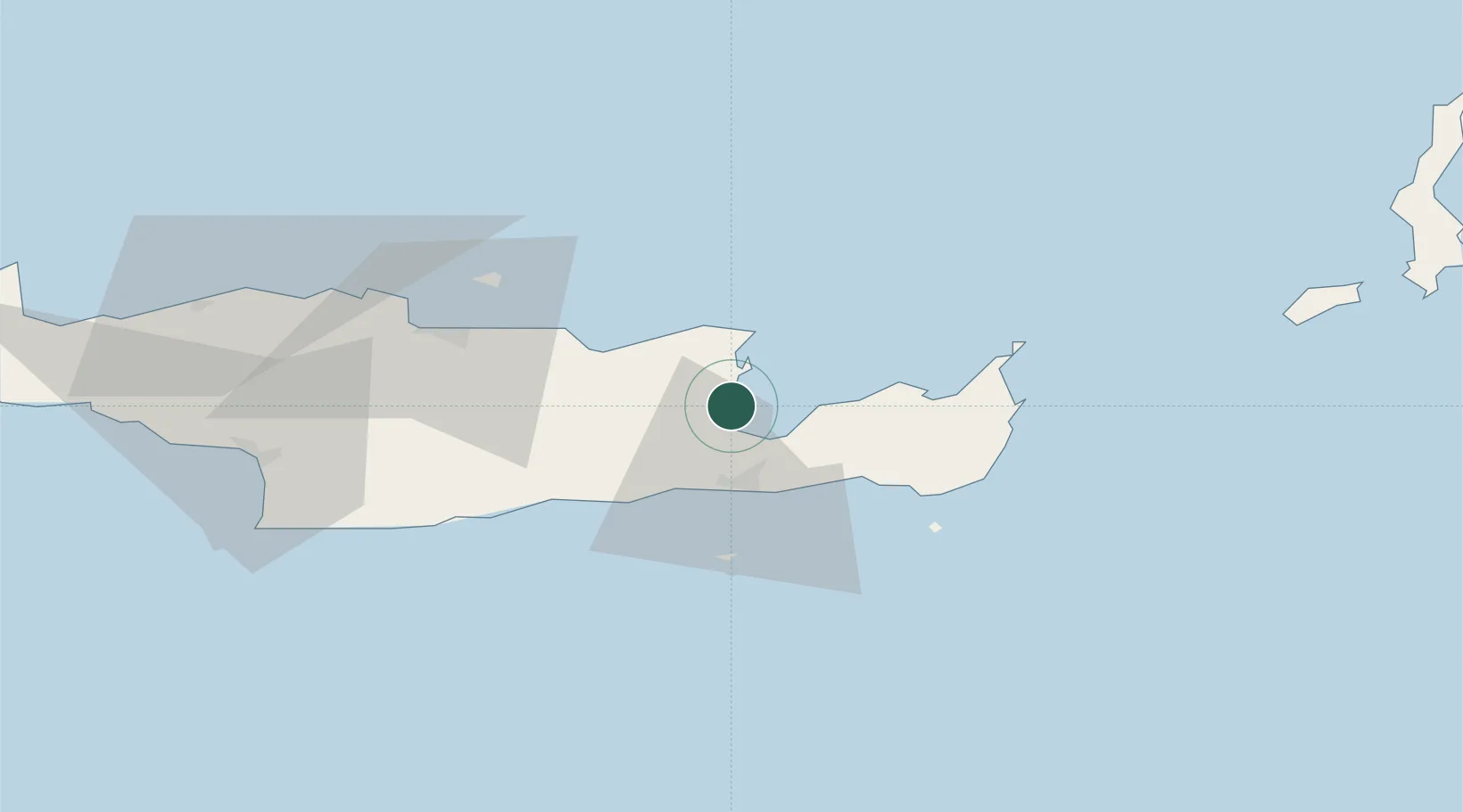
Nearby Logistics Neighbours

Cities
  1. 1Altsi15 km
  2. 2Ierápetra20 km
  3. 3Malia25 km
  4. 4Makriyialos28 km
  5. 5Siteía36 km
Nearest neighbours — logibook spatial index (haversine) over the source coordinates
Ports
  1. 1Sitia38 km
  2. 2Iraklion55 km
  3. 3Kali Limenes85 km
  4. 4Rethimnon115 km
  5. 5Soudha143 km
Nearest neighbours — logibook spatial index (haversine) over the source coordinates
Airports
  1. 1Sitia Airport35 km
  2. 2(Duplicate)Kasteli Hellenic Air Force Base36 km
  3. 3Heraklion International Nikos Kazantzakis Airport52 km
  4. 4Kasos Airport112 km
  5. 5Karpathos Airport132 km
Nearest neighbours — logibook spatial index (haversine) over the source coordinates
Trade Zones
  1. 1Free Zone of Heraklion58 km
  2. 2Free Zone of Piraeus360 km
  3. 3Tire Organized Industrial Zone372 km
  4. 4Aegean Free Zone373 km
  5. 5Tobruk Free Zone386 km
Nearest neighbours — logibook spatial index (haversine) over the source coordinates
DatabookThe Record of Consolidated Knowledge
Greece beyond logistics?
Browse databook

All Sources

LocationsUN/LOCODE
UN/LOCODE — free
Portsthe NGA World Port Index
Public domain (US gov)
AirportsOurAirports
Public domain
Trade Zonesthe World Bank SEZ database
CC BY 4.0
Trade ZonesOpen Zone Map
CC BY
← Greece locations