UN/LOCODE hub · France
FRT62

Tardinghen

50.8667°, 1.6333°
128
Population
1
Transport functions

Transport Functions

Multimodal
UN/LOCODE

Hub Profile

Place type
Populated place
GeoNames
Region
Hauts-de-France
GeoNames
Population
128
GeoNames
Time zone
Europe/Paris
GeoNames
Elevation
26 m
GeoNames

Location

Location of FRT62
Natural Earth 10m (public domain) · Hauts-de-France · FRT62 · 50.87, 1.63GoogleOSMYandex

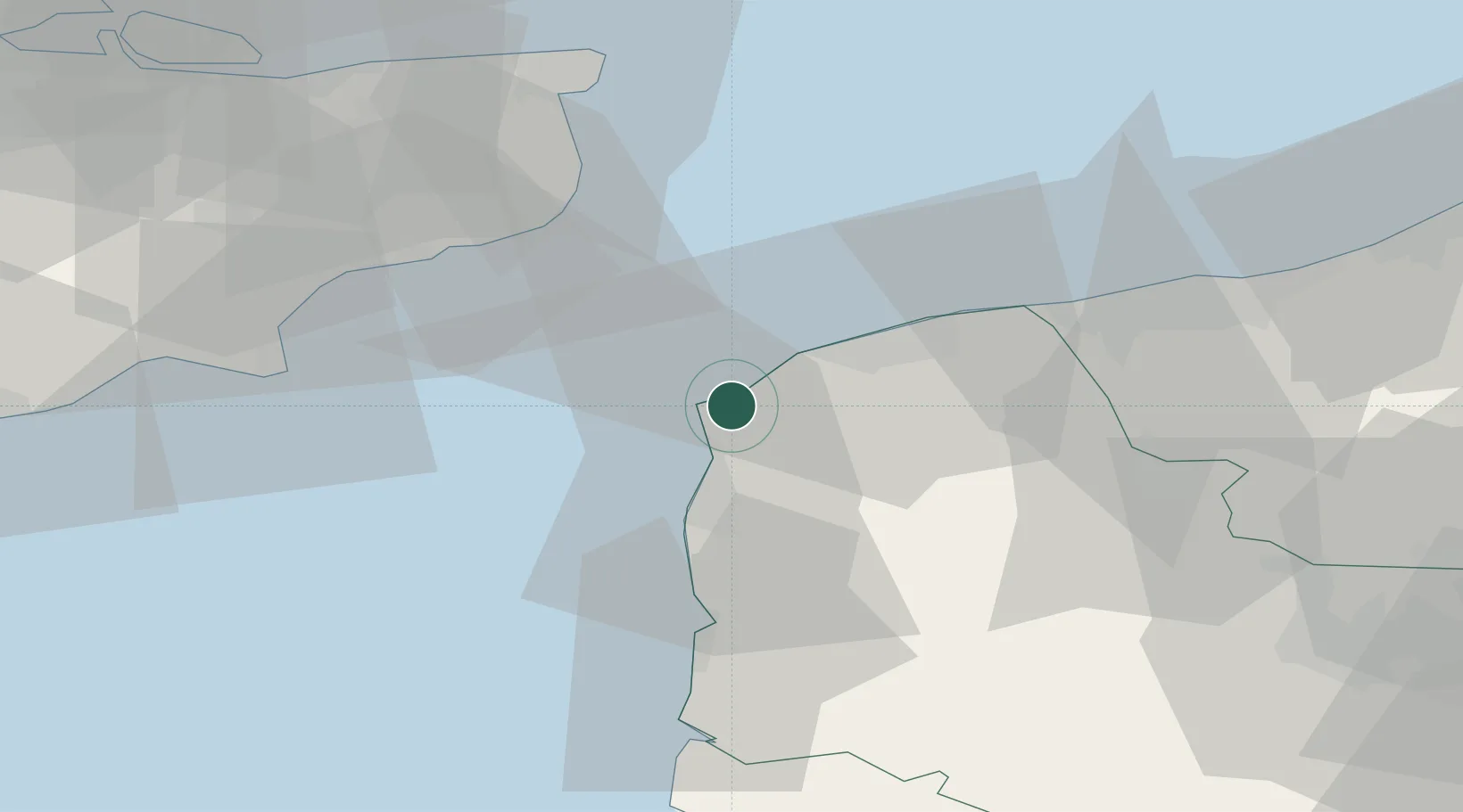
Nearby Logistics Neighbours

Cities
  1. 1Wissant3 km
  2. 2Sangatte11 km
  3. 3Wimereux11 km
  4. 4Fréthun14 km
  5. 5Guînes16 km
Nearest neighbours — logibook spatial index (haversine) over the source coordinates
Ports
  1. 1Boulogne-Sur-Mer15 km
  2. 2Calais19 km
  3. 3Dover Harbor35 km
  4. 4Gravelines37 km
  5. 5Folkestone Harbour39 km
Nearest neighbours — logibook spatial index (haversine) over the source coordinates
Airports
  1. 1Calais Marck Airport25 km
  2. 2Le Touquet-Côte d'Opale Airport39 km
  3. 3Lydd London Ashford Airport50 km
  4. 4Koksijde Air Base76 km
  5. 5Merville-Calonne Airport76 km
Nearest neighbours — logibook spatial index (haversine) over the source coordinates
Trade Zones
  1. 1ZFU Calais17 km
  2. 2Discovery Park - Sandwich Enterprise Zone51 km
  3. 3ZFU Saint Pol sur Mer52 km
  4. 4Port of Sheerness Free Zone89 km
  5. 5ZFU de Lille et de Loos101 km
Nearest neighbours — logibook spatial index (haversine) over the source coordinates
DatabookThe Record of Consolidated Knowledge
France beyond logistics?
Browse databook

All Sources

LocationsUN/LOCODE
UN/LOCODE — free
LocationsGeoNames
CC BY 4.0
Portsthe NGA World Port Index
Public domain (US gov)
AirportsOurAirports
Public domain
Trade Zonesthe World Bank SEZ database
CC BY 4.0
Trade ZonesOpen Zone Map
CC BY
← France locations