UN/LOCODE hub · France
FRH2G

Vescovato

42.4833°, 9.4333°
2,555
Population
1
Transport functions

Transport Functions

Multimodal
UN/LOCODE

Hub Profile

Place type
Populated place
GeoNames
Region
Corsica
GeoNames
Population
2,555
GeoNames
Time zone
Europe/Paris
GeoNames
Elevation
174 m
GeoNames

Location

Location of FRH2G
Natural Earth 10m (public domain) · Corsica · FRH2G · 42.48, 9.43GoogleOSMYandex

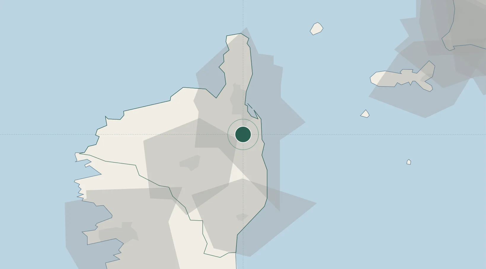
Nearby Logistics Neighbours

Cities
  1. 1Borgo8 km
  2. 2Rapaggio14 km
  3. 3San-Nicolao14 km
  4. 4Santa-Maria-Poggio18 km
  5. 5Furiani19 km
Nearest neighbours — logibook spatial index (haversine) over the source coordinates
Ports
  1. 1Bastia24 km
  2. 2L'ile Rousse44 km
  3. 3Calvi57 km
  4. 4Portoferraio82 km
  5. 5Port D' Ajaccio85 km
Nearest neighbours — logibook spatial index (haversine) over the source coordinates
Airports
  1. 1Bastia-Poretta International airport9 km
  2. 2Calvi Sainte Catherine Airport53 km
  3. 3Solenzara (BA 126) Air Base62 km
  4. 4Marina di Campo Airport73 km
  5. 5Ajaccio Napoléon Bonaparte airport81 km
Nearest neighbours — logibook spatial index (haversine) over the source coordinates
Trade Zones
  1. 1Sardinia Special Economic Zone Area214 km
  2. 2ZFU LAriane224 km
  3. 3ZFU Toulon294 km
  4. 4ZFU La Seyne-sur-Mer300 km
  5. 5Abruzzo Special Economic Zone322 km
Nearest neighbours — logibook spatial index (haversine) over the source coordinates
DatabookThe Record of Consolidated Knowledge
France beyond logistics?
Browse databook

All Sources

LocationsUN/LOCODE
UN/LOCODE — free
LocationsGeoNames
CC BY 4.0
Portsthe NGA World Port Index
Public domain (US gov)
AirportsOurAirports
Public domain
Trade Zonesthe World Bank SEZ database
CC BY 4.0
Trade ZonesOpen Zone Map
CC BY
← France locations