UN/LOCODE hub · Finland
FIMHQ

Maarianhamina (Mariehamn)

60.1000°, 19.9500°
2
Transport functions

Transport Functions

Port
Airport
Maarianhamina (Mariehamn) is also a profiled seaport →
UN/LOCODE

Hub Profile

Region
01
GeoNames

Location

Location of FIMHQ
Natural Earth 10m (public domain) · 01 · FIMHQ · 60.10, 19.95GoogleOSMYandex

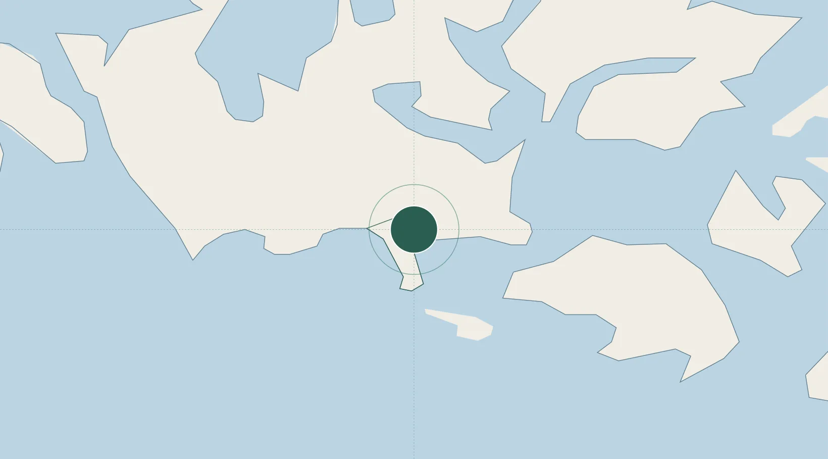
Nearby Logistics Neighbours

Cities
  1. 1Maarianhamina (Mariehamn)0 km
  2. 2Gottby (Godby)8 km
  3. 3Färjsundet15 km
  4. 4Marsund18 km
  5. 5Eckerö23 km
Nearest neighbours — logibook spatial index (haversine) over the source coordinates
Ports
  1. 1Grisslehamn63 km
  2. 2Hallstavik76 km
  3. 3Hargshamn84 km
  4. 4Uto86 km
  5. 5Uusikaupunki111 km
Nearest neighbours — logibook spatial index (haversine) over the source coordinates
Airports
  1. 1Mariehamn Airport4 km
  2. 2Stockholm-Arlanda Airport124 km
  3. 3Stockholm-Bromma Airport140 km
  4. 4Gävle Sandviken Airport174 km
  5. 5Pori Airport182 km
Nearest neighbours — logibook spatial index (haversine) over the source coordinates
Trade Zones
  1. 1Turku Free Zone131 km
  2. 2Stockholm Free Zone133 km
  3. 3Freeport of Hanko166 km
  4. 4Paldiski Free Zone247 km
  5. 5Muuga Free Zone298 km
Nearest neighbours — logibook spatial index (haversine) over the source coordinates
DatabookThe Record of Consolidated Knowledge
Finland beyond logistics?
Browse databook

All Sources

LocationsUN/LOCODE
UN/LOCODE — free
Portsthe NGA World Port Index
Public domain (US gov)
AirportsOurAirports
Public domain
Trade Zonesthe World Bank SEZ database
CC BY 4.0
Trade ZonesOpen Zone Map
CC BY
← Finland locations