UN/LOCODE hub · Spain
ESZLD

San Cayetano

37.8167°, -0.9000°
1
Transport functions

Transport Functions

Multimodal
UN/LOCODE

Hub Profile

Place type
Populated place
GeoNames
Region
Murcia
GeoNames
Time zone
Europe/Madrid
GeoNames
Elevation
63 m
GeoNames

Location

Location of ESZLD
Natural Earth 10m (public domain) · Murcia · ESZLD · 37.82, -0.90GoogleOSMYandex

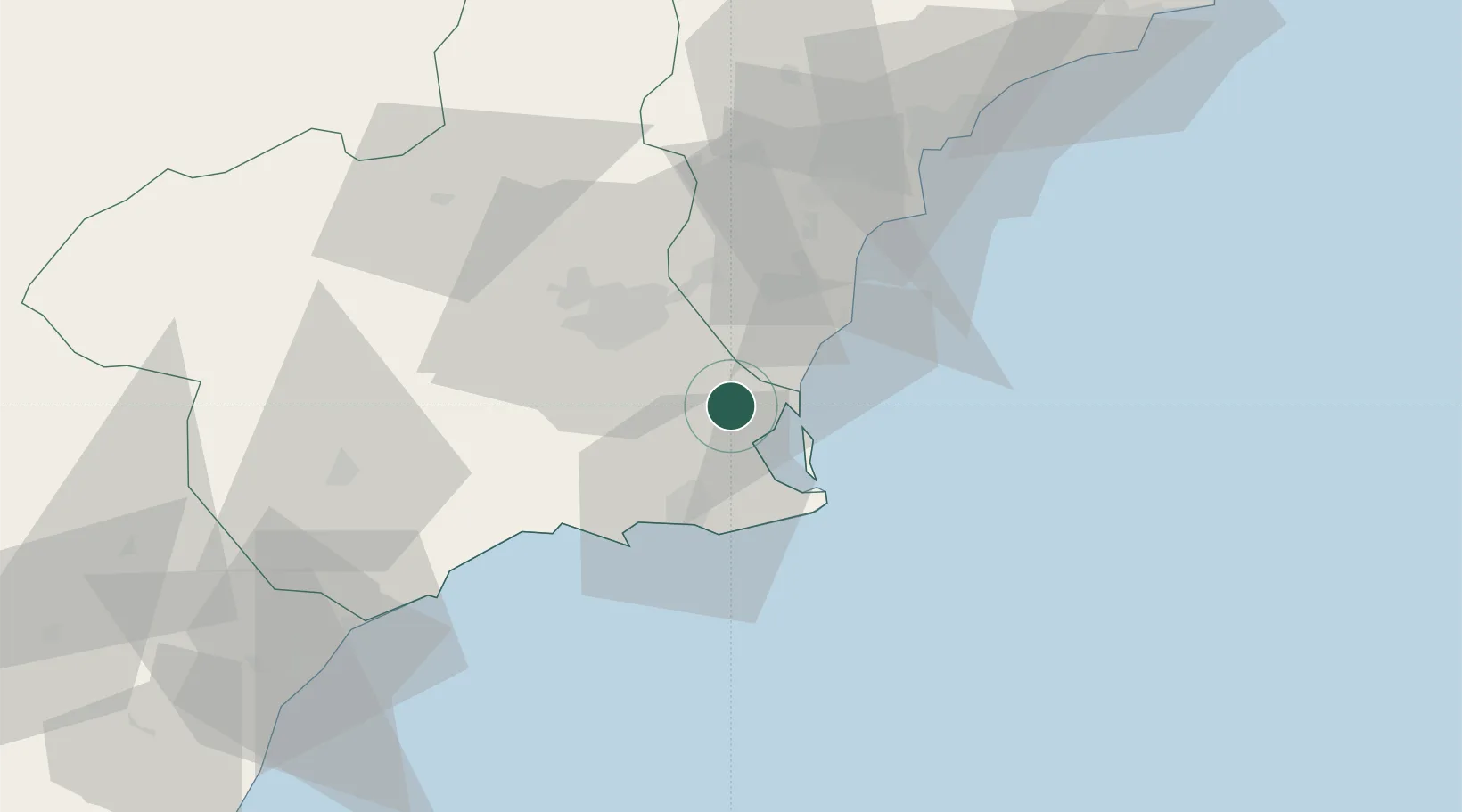
Nearby Logistics Neighbours

Cities
  1. 1Balsicas4 km
  2. 2El Mirador5 km
  3. 3Roldan9 km
  4. 4Jimenado14 km
  5. 5Torre Horadada14 km
Nearest neighbours — logibook spatial index (haversine) over the source coordinates
Ports
  1. 1Torrevieja25 km
  2. 2Cartagena27 km
  3. 3Alicante68 km
  4. 4Aguilas75 km
  5. 5Puerto De Garrucha107 km
Nearest neighbours — logibook spatial index (haversine) over the source coordinates
Airports
  1. 1San Javier Airport9 km
  2. 2Region of Murcia International Airport20 km
  3. 3Alcantarilla Air Base33 km
  4. 4Alicante-Elche Miguel Hernández Airport60 km
  5. 5Albacete Airport / Los Llanos Air Base151 km
Nearest neighbours — logibook spatial index (haversine) over the source coordinates
Trade Zones
  1. 1Depósito Franco de Alicante68 km
  2. 2Depósito Franco de Valencia188 km
  3. 3Depósito Franco de Málaga331 km
  4. 4Melilla Autonomous Community335 km
  5. 5Berkane Agro-Pole343 km
Nearest neighbours — logibook spatial index (haversine) over the source coordinates
DatabookThe Record of Consolidated Knowledge
Spain beyond logistics?
Browse databook

All Sources

LocationsUN/LOCODE
UN/LOCODE — free
Portsthe NGA World Port Index
Public domain (US gov)
AirportsOurAirports
Public domain
Trade Zonesthe World Bank SEZ database
CC BY 4.0
Trade ZonesOpen Zone Map
CC BY
← Spain locations