UN/LOCODE hub · Estonia
EELPN

Leppneeme Kalasadam

59.5500°, 24.8667°
1
Transport functions

Transport Functions

Port
UN/LOCODE

Hub Profile

Region
37
GeoNames

Location

Location of EELPN
Natural Earth 10m (public domain) · 37 · EELPN · 59.55, 24.87GoogleOSMYandex

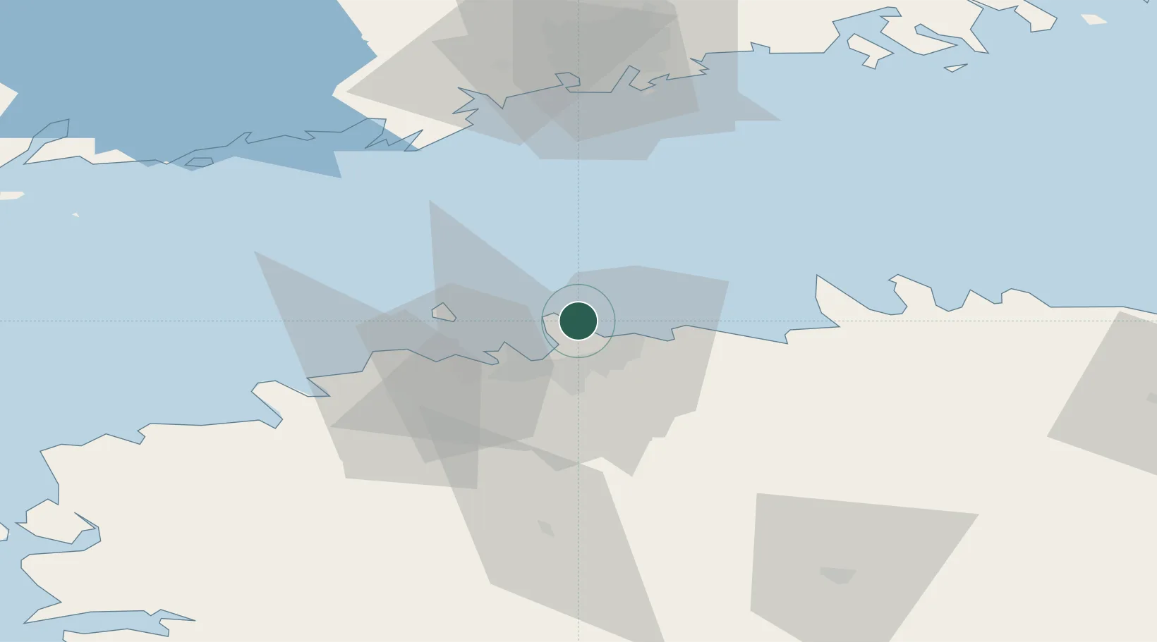
Nearby Logistics Neighbours

Cities
  1. 1Kelvingi2 km
  2. 2Leppneeme2 km
  3. 3Tammneeme Sadam4 km
  4. 4Oti4 km
  5. 5Rohuneeme Väikesadam4 km
Nearest neighbours — logibook spatial index (haversine) over the source coordinates
Ports
  1. 1Miiduranna6 km
  2. 2Muuga-Port of Tallin8 km
  3. 3Vanasadam - Port of Tallinn13 km
  4. 4Paljassaare14 km
  5. 5Lahesuu14 km
Nearest neighbours — logibook spatial index (haversine) over the source coordinates
Airports
  1. 1Tallinn Linnahall Heliport13 km
  2. 2Lennart Meri Tallinn Airport15 km
  3. 3Ämari Air Base50 km
  4. 4Helsinki Vantaa Airport86 km
  5. 5Pärnu Airport128 km
Nearest neighbours — logibook spatial index (haversine) over the source coordinates
Trade Zones
  1. 1Muuga Free Zone29 km
  2. 2Paldiski Free Zone51 km
  3. 3Freeport of Hanko116 km
  4. 4Port of Hamina-Kotka154 km
  5. 5Port of Sillamäe162 km
Nearest neighbours — logibook spatial index (haversine) over the source coordinates
DatabookThe Record of Consolidated Knowledge
Estonia beyond logistics?
Browse databook

All Sources

LocationsUN/LOCODE
UN/LOCODE — free
Portsthe NGA World Port Index
Public domain (US gov)
AirportsOurAirports
Public domain
Trade Zonesthe World Bank SEZ database
CC BY 4.0
Trade ZonesOpen Zone Map
CC BY
← Estonia locations