UN/LOCODE hub · Estonia
EEKUG

Narva Kulgu Sadam

59.3500°, 28.1667°
1
Transport functions

Transport Functions

Port
UN/LOCODE

Hub Profile

Region
45
GeoNames

Location

Location of EEKUG
Natural Earth 10m (public domain) · 45 · EEKUG · 59.35, 28.17GoogleOSMYandex

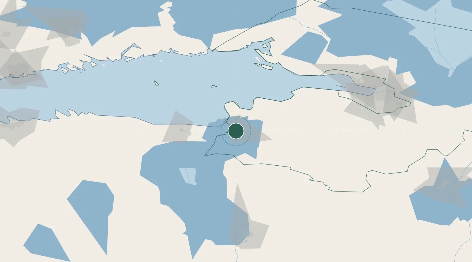
Nearby Logistics Neighbours

Cities
  1. 1Narva4 km
  2. 2Narva Linnasadam4 km
  3. 3Narva-Jõesuu Sadam15 km
  4. 4Suur-Lootsi15 km
  5. 5Vaivara24 km
Nearest neighbours — logibook spatial index (haversine) over the source coordinates
Ports
  1. 1Sillamae26 km
  2. 2Ust Luga36 km
  3. 3Kunda94 km
  4. 4Lomonosov110 km
  5. 5Kronshtadt115 km
Nearest neighbours — logibook spatial index (haversine) over the source coordinates
Airports
  1. 1Smuravyovo Air Base60 km
  2. 2Pribylovo Naval Air Base127 km
  3. 3Pushkin Airport128 km
  4. 4Pulkovo Airport128 km
  5. 5Levashovo Air Base140 km
Nearest neighbours — logibook spatial index (haversine) over the source coordinates
Trade Zones
  1. 1Port of Sillamäe26 km
  2. 2St Petersburg Technology Innovative Special Economic Zone117 km
  3. 3Port of Hamina-Kotka142 km
  4. 4Moglino Special Economic Zone - Industrial177 km
  5. 5Muuga Free Zone179 km
Nearest neighbours — logibook spatial index (haversine) over the source coordinates
DatabookThe Record of Consolidated Knowledge
Estonia beyond logistics?
Browse databook

All Sources

LocationsUN/LOCODE
UN/LOCODE — free
Portsthe NGA World Port Index
Public domain (US gov)
AirportsOurAirports
Public domain
Trade Zonesthe World Bank SEZ database
CC BY 4.0
Trade ZonesOpen Zone Map
CC BY
← Estonia locations