UN/LOCODE hub · Denmark
DKSPE

Spentrup

56.5500°, 10.0333°
2,155
Population
1
Transport functions

Transport Functions

Multimodal
UN/LOCODE

Hub Profile

Place type
Populated place
GeoNames
Region
Central Jutland
GeoNames
Population
2,155
GeoNames
Time zone
Europe/Copenhagen
GeoNames
Elevation
45 m
GeoNames

Location

Location of DKSPE
Natural Earth 10m (public domain) · Central Jutland · DKSPE · 56.55, 10.03GoogleOSMYandex

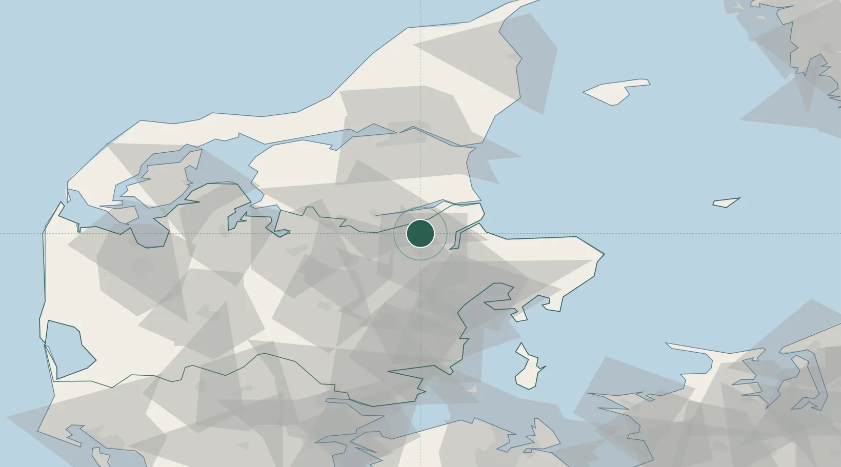
Nearby Logistics Neighbours

Cities
  1. 1Mariager11 km
  2. 2Maasholm15 km
  3. 3Kongsdal Harbour17 km
  4. 4Hadsund19 km
  5. 5Langå21 km
Nearest neighbours — logibook spatial index (haversine) over the source coordinates
Ports
  1. 1Randers9 km
  2. 2Mariager12 km
  3. 3Hobro17 km
  4. 4Hadsund19 km
  5. 5Studstrup39 km
Nearest neighbours — logibook spatial index (haversine) over the source coordinates
Airports
  1. 1Aarhus Airport45 km
  2. 2Aarhus Seaplane Terminal46 km
  3. 3Skive Airport53 km
  4. 4Aalborg Airport62 km
  5. 5Midtjyllands Airport / Air Base Karup64 km
Nearest neighbours — logibook spatial index (haversine) over the source coordinates
Trade Zones
  1. 1Gothenburg Boundless Customs Warehouse168 km
  2. 2Freeport of Copenhagen- Nordhavn184 km
  3. 3MTS Malmö Transport and Spedition217 km
  4. 4Freeport of Kiel247 km
  5. 5Jönköping Free Zone280 km
Nearest neighbours — logibook spatial index (haversine) over the source coordinates
DatabookThe Record of Consolidated Knowledge
Denmark beyond logistics?
Browse databook

All Sources

LocationsUN/LOCODE
UN/LOCODE — free
LocationsGeoNames
CC BY 4.0
Portsthe NGA World Port Index
Public domain (US gov)
AirportsOurAirports
Public domain
Trade Zonesthe World Bank SEZ database
CC BY 4.0
Trade ZonesOpen Zone Map
CC BY
← Denmark locations