UN/LOCODE hub · Denmark
DKROF

Rødby

54.6833°, 11.3833°
2
Transport functions

Transport Functions

Port
Road
Rødby is also a profiled seaport →
UN/LOCODE

Hub Profile

Region
85
GeoNames

Location

Location of DKROF
Natural Earth 10m (public domain) · 85 · DKROF · 54.68, 11.38GoogleOSMYandex

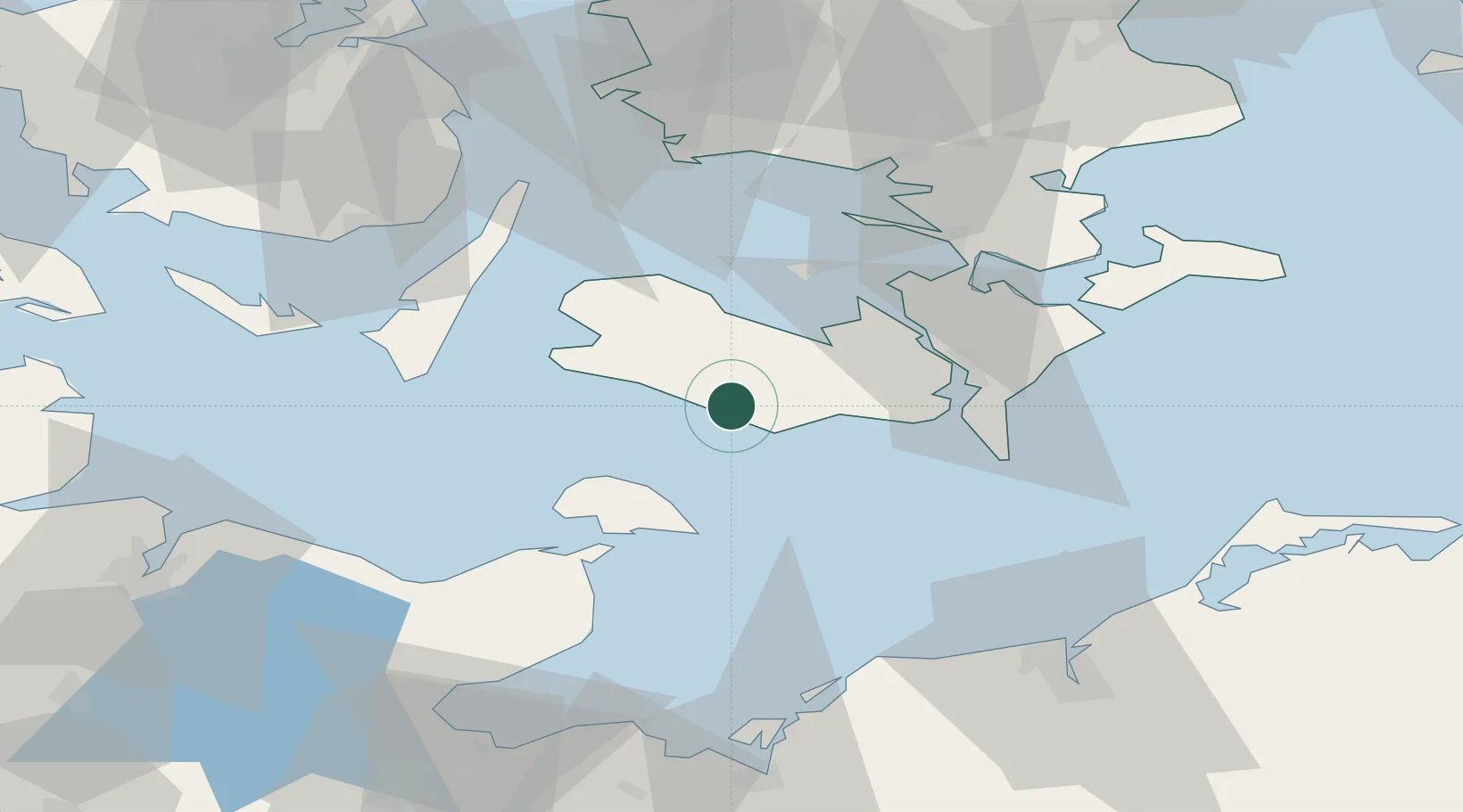
Nearby Logistics Neighbours

Cities
  1. 1Rødbyhavn4 km
  2. 2Burso9 km
  3. 3Nørreballe13 km
  4. 4Dannemare14 km
  5. 5Reersoe20 km
Nearest neighbours — logibook spatial index (haversine) over the source coordinates
Ports
  1. 1Bandholm18 km
  2. 2Sakskobing21 km
  3. 3Nysted23 km
  4. 4Nakskov23 km
  5. 5Nykobing32 km
Nearest neighbours — logibook spatial index (haversine) over the source coordinates
Airports
  1. 1Lolland Falster Maribo Airport4 km
  2. 2Ærø Airfield62 km
  3. 3Sydfyn (Tasinge) Airfield64 km
  4. 4Kiel-Holtenau Airport87 km
  5. 5Ringsted Airfield87 km
Nearest neighbours — logibook spatial index (haversine) over the source coordinates
Trade Zones
  1. 1Freeport of Kiel87 km
  2. 2Freeport of Copenhagen- Nordhavn138 km
  3. 3MTS Malmö Transport and Spedition150 km
  4. 4Freeport of Cuxhaven (Freihafen Cuxhaven)206 km
  5. 5Swinoujscie Duty Free Zone207 km
Nearest neighbours — logibook spatial index (haversine) over the source coordinates
DatabookThe Record of Consolidated Knowledge
Denmark beyond logistics?
Browse databook

All Sources

LocationsUN/LOCODE
UN/LOCODE — free
Portsthe NGA World Port Index
Public domain (US gov)
AirportsOurAirports
Public domain
Trade Zonesthe World Bank SEZ database
CC BY 4.0
Trade ZonesOpen Zone Map
CC BY
← Denmark locations