UN/LOCODE hub · Denmark
DKJEL

Jelling

55.7500°, 9.4333°
3,658
Population
1
Transport functions

Transport Functions

Port
UN/LOCODE

Hub Profile

Place type
Populated place
GeoNames
Region
South Denmark
GeoNames
Population
3,658
GeoNames
Time zone
Europe/Copenhagen
GeoNames
Elevation
110 m
GeoNames

Location

Location of DKJEL
Natural Earth 10m (public domain) · South Denmark · DKJEL · 55.75, 9.43GoogleOSMYandex

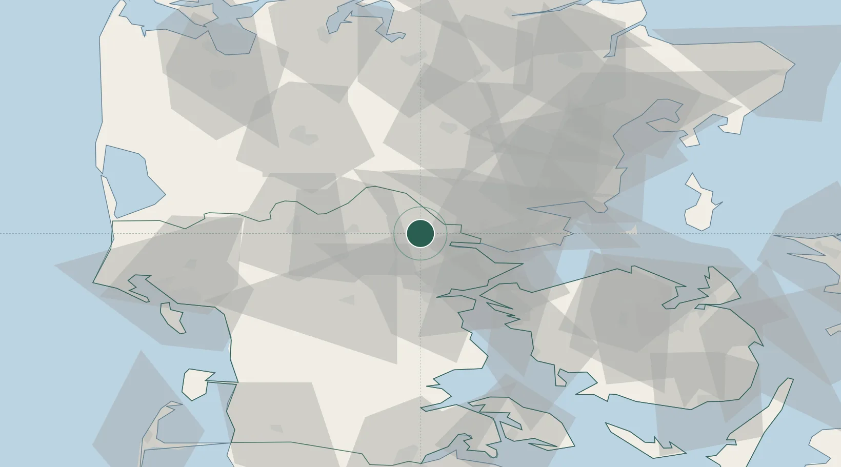
Nearby Logistics Neighbours

Cities
  1. 1Gadbjerg8 km
  2. 2Brejning18 km
  3. 3Nørre Snede23 km
  4. 4Vorbasse26 km
  5. 5Odense26 km
Nearest neighbours — logibook spatial index (haversine) over the source coordinates
Ports
  1. 1Vejle8 km
  2. 2Skaerbaek28 km
  3. 3Horsens29 km
  4. 4Fredericia29 km
  5. 5Kolding30 km
Nearest neighbours — logibook spatial index (haversine) over the source coordinates
Airports
  1. 1Billund Airport17 km
  2. 2Kolding Vamdrup Airfield36 km
  3. 3Skrydstrup Air Base60 km
  4. 4Esbjerg Airport61 km
  5. 5Odense Hans Christian Andersen Airport64 km
Nearest neighbours — logibook spatial index (haversine) over the source coordinates
Trade Zones
  1. 1Freeport of Kiel164 km
  2. 2Freeport of Copenhagen- Nordhavn198 km
  3. 3Freeport of Cuxhaven (Freihafen Cuxhaven)221 km
  4. 4MTS Malmö Transport and Spedition230 km
  5. 5Gothenburg Boundless Customs Warehouse261 km
Nearest neighbours — logibook spatial index (haversine) over the source coordinates
DatabookThe Record of Consolidated Knowledge
Denmark beyond logistics?
Browse databook

All Sources

LocationsUN/LOCODE
UN/LOCODE — free
LocationsGeoNames
CC BY 4.0
Portsthe NGA World Port Index
Public domain (US gov)
AirportsOurAirports
Public domain
Trade Zonesthe World Bank SEZ database
CC BY 4.0
Trade ZonesOpen Zone Map
CC BY
← Denmark locations