UN/LOCODE hub · China
CNXIT

Xintang Pt

23.0771°, 113.5623°
1
Transport functions

Transport Functions

Port
UN/LOCODE

Hub Profile

Region
GD
GeoNames
Logistics facilities
4
UN/LOCODE

Location

Location of CNXIT
Natural Earth 10m (public domain) · GD · CNXIT · 23.08, 113.56GoogleOSMYandex

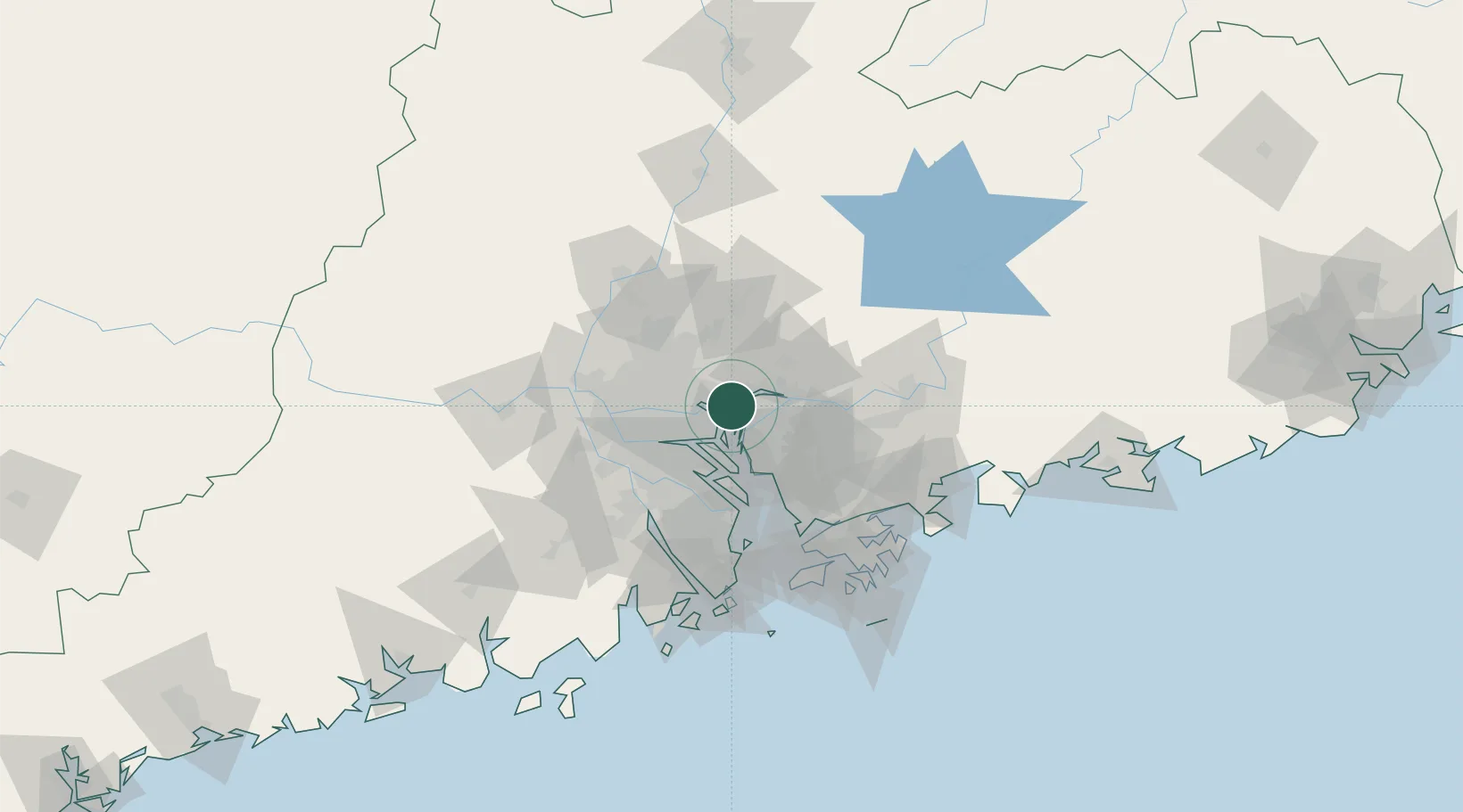
Nearby Logistics Neighbours

Cities
  1. 1Huangpu New Port3 km
  2. 2Huangpu Pt8 km
  3. 3Zhongtang9 km
  4. 4Shilou9 km
  5. 5Xinsha11 km
Nearest neighbours — logibook spatial index (haversine) over the source coordinates
Ports
  1. 1Huangpuxingang7 km
  2. 2Huangpu15 km
  3. 3Guangzhou34 km
  4. 4Shekou75 km
  5. 5Yantian91 km
Nearest neighbours — logibook spatial index (haversine) over the source coordinates
Airports
  1. 1Guangzhou Baiyun International Airport44 km
  2. 2Foshan Shadi Airport50 km
  3. 3Shenzhen Bao'an International Airport55 km
  4. 4Shek Kong Air Base89 km
  5. 5Hong Kong International Airport93 km
Nearest neighbours — logibook spatial index (haversine) over the source coordinates
Trade Zones
  1. 1Guangzhou Export Processing Zone5 km
  2. 2Yunpu Industrial Park9 km
  3. 3Dongguan Water Town Development Zone38 km
  4. 4Longhu Industrial Park39 km
  5. 5Baiyun Industrial Park41 km
Nearest neighbours — logibook spatial index (haversine) over the source coordinates
DatabookThe Record of Consolidated Knowledge
China beyond logistics?
Browse databook

All Sources

LocationsUN/LOCODE
UN/LOCODE — free
Portsthe NGA World Port Index
Public domain (US gov)
AirportsOurAirports
Public domain
Trade Zonesthe World Bank SEZ database
CC BY 4.0
Trade ZonesOpen Zone Map
CC BY
← China locations