UN/LOCODE hub · Chile
CLCHB

Chacabuco

-45.4833°, -72.8167°
1
Transport functions

Transport Functions

Port
UN/LOCODE

Hub Profile

Place type
Populated place
GeoNames
Region
Aysén
GeoNames
Time zone
America/Coyhaique
GeoNames
Elevation
217 m
GeoNames

Location

Location of CLCHB
Natural Earth 10m (public domain) · Aysén · CLCHB · -45.48, -72.82GoogleOSMYandex

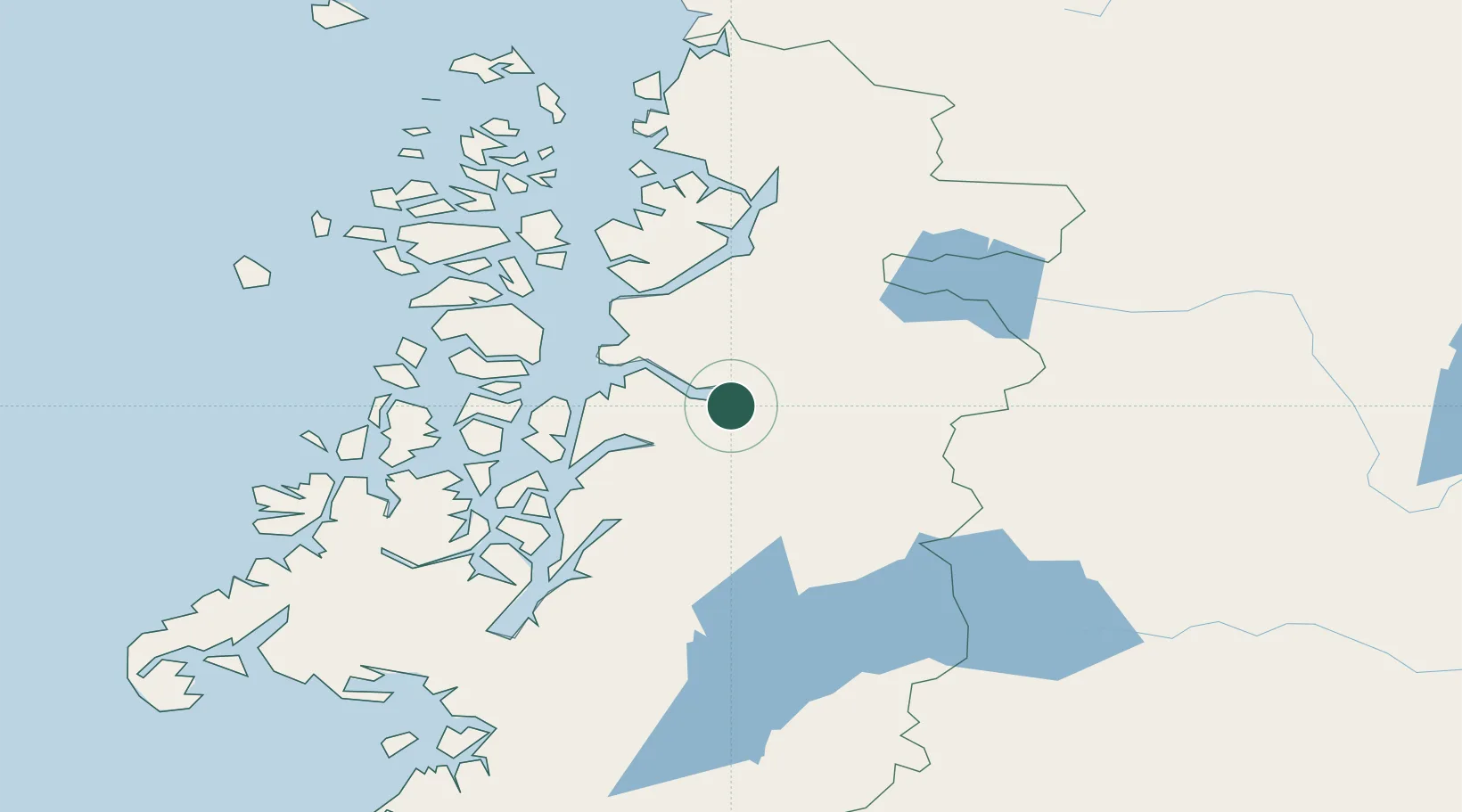
Nearby Logistics Neighbours

Cities
  1. 1Puerto Chacabuco1 km
  2. 2Puerto Aisén14 km
  3. 3Puerto Cisnes84 km
  4. 4Melinka194 km
  5. 5Guaitecas213 km
Nearest neighbours — logibook spatial index (haversine) over the source coordinates
Ports
  1. 1Puerto Chacabuco2 km
  2. 2Puerto Castro342 km
  3. 3Puerto Quemchi375 km
  4. 4Comodoro Rivadavia418 km
  5. 5Puerto Montt445 km
Nearest neighbours — logibook spatial index (haversine) over the source coordinates
Airports
  1. 1Teniente Vidal Airport57 km
  2. 2Balmaceda Airport100 km
  3. 3Chile Chico Airport150 km
  4. 4Perito Moreno Jalil Hamer Airport184 km
  5. 5Cochrane Airport197 km
Nearest neighbours — logibook spatial index (haversine) over the source coordinates
DatabookThe Record of Consolidated Knowledge
Chile beyond logistics?
Browse databook

All Sources

LocationsUN/LOCODE
UN/LOCODE — free
Portsthe NGA World Port Index
Public domain (US gov)
AirportsOurAirports
Public domain
Trade Zonesthe World Bank SEZ database
CC BY 4.0
Trade ZonesOpen Zone Map
CC BY
← Chile locations