UN/LOCODE hub · Canada
CASCE

Shubenacadie

45.0833°, -63.4000°
411
Population
2
Transport functions

Transport Functions

Rail
Road
UN/LOCODE

Hub Profile

Place type
Populated place
GeoNames
Region
Nova Scotia
GeoNames
Population
411
GeoNames
Time zone
America/Halifax
GeoNames
Elevation
16 m
GeoNames

Location

Location of CASCE
Natural Earth 10m (public domain) · Nova Scotia · CASCE · 45.08, -63.40GoogleOSMYandex

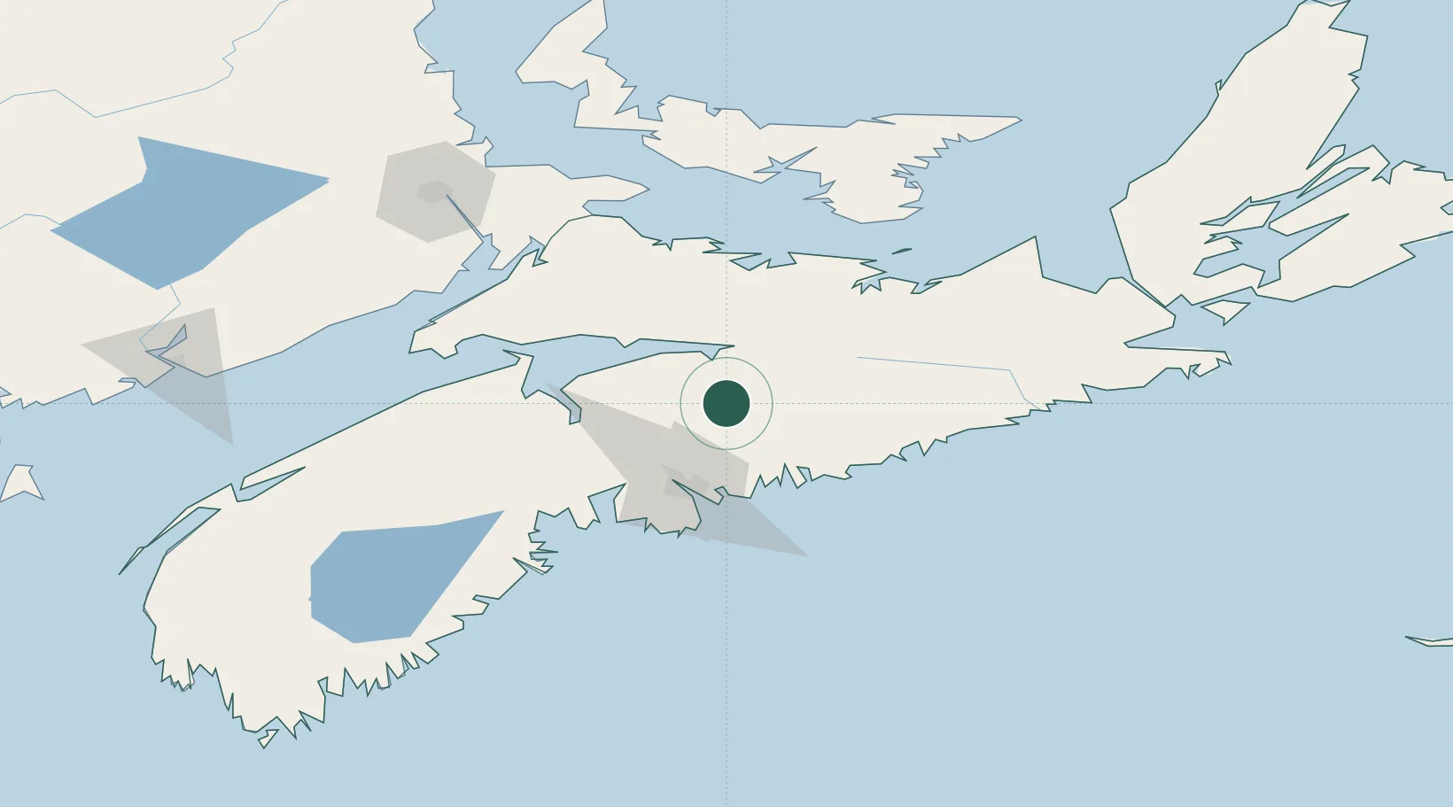
Nearby Logistics Neighbours

Cities
  1. 1Stewiacke8 km
  2. 2Brookfield21 km
  3. 3Densmore Mills34 km
  4. 4Fall River34 km
  5. 5Waverley37 km
Nearest neighbours — logibook spatial index (haversine) over the source coordinates
Ports
  1. 1Musquodoboit Harbour39 km
  2. 2Halifax50 km
  3. 3Windsor60 km
  4. 4Pictou84 km
  5. 5Charlottetown130 km
Nearest neighbours — logibook spatial index (haversine) over the source coordinates
Airports
  1. 1Halifax / Stanfield International Airport24 km
  2. 2Fox Harbour Airport88 km
  3. 3CFB Greenwood120 km
  4. 4Charlottetown Airport136 km
  5. 5Greater Moncton Roméo LeBlanc International Airport152 km
Nearest neighbours — logibook spatial index (haversine) over the source coordinates
Trade Zones
  1. 1Halifax Gateway50 km
  2. 2Saint John210 km
  3. 3Cape Breton Regional Municipality Foreign Trade Zone239 km
  4. 4FTZ No. 058 Bangor427 km
  5. 5FTZ No. 179 Madawaska452 km
Nearest neighbours — logibook spatial index (haversine) over the source coordinates
DatabookThe Record of Consolidated Knowledge
Canada beyond logistics?
Browse databook

All Sources

LocationsUN/LOCODE
UN/LOCODE — free
LocationsGeoNames
CC BY 4.0
Portsthe NGA World Port Index
Public domain (US gov)
AirportsOurAirports
Public domain
Trade Zonesthe World Bank SEZ database
CC BY 4.0
Trade ZonesOpen Zone Map
CC BY
← Canada locations