Diversified Zone · China

Bali Street Industrial Park Active

25.3513°, 110.3120°
1,075 ha
Zone area
386.6 km
Nearest port
31.1 km
Nearest airport

Gateway access

Nearest neighbours — logibook spatial index (haversine) over the source coordinates

Zone profile

Zone type
Diversified Zone
Open Zone Map
Region
Guangxi
Open Zone Map
Status
Active
Open Zone Map
Management
Public
Open Zone Map
Operator
Bali Street Industrial Park Management Committee
Open Zone Map
Legal framework
Guangxi Provincial Committee of the Communist Party of China, Guangxi Provincial People's Government: Decision on Accelerating the Construction of a Modern Industrial System (July 27, 2020), Several Opinions of the General Office of the State Council on P
Open Zone Map

Location

Location of ozm-5277
Natural Earth 10m (public domain) · Guangxi · ozm-5277 · 25.35, 110.31GoogleOSMYandex

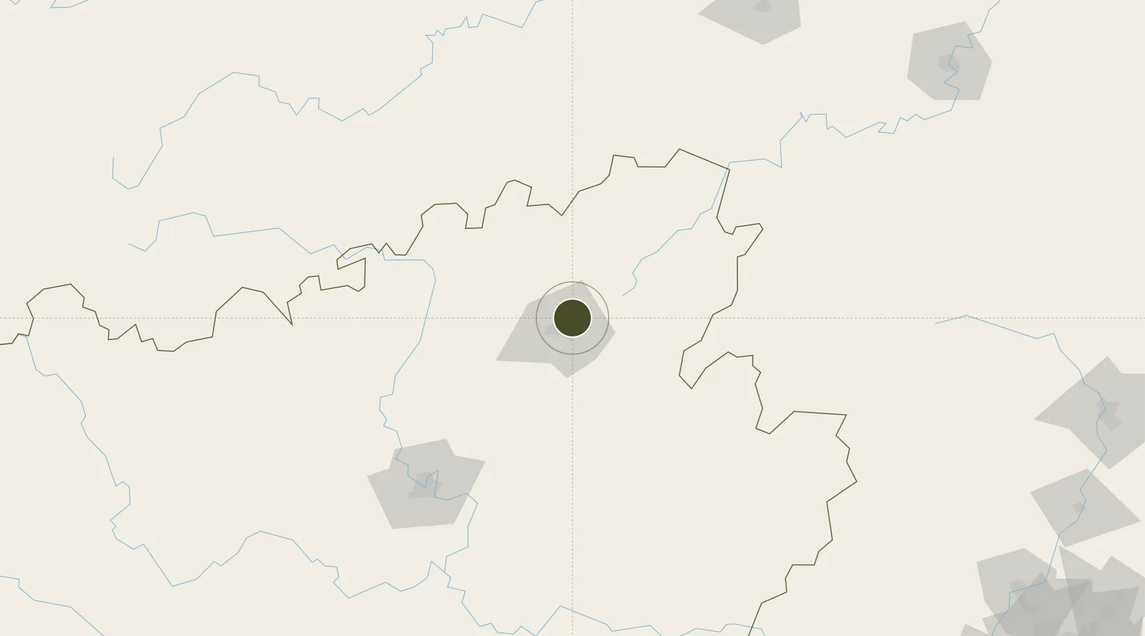
Nearby Logistics Neighbours

Ports
  1. 1Guangzhou387 km
  2. 2Huangpu403 km
  3. 3Huangpuxingang412 km
  4. 4Shui Dong437 km
  5. 5Qinzhou439 km
Nearest neighbours — logibook spatial index (haversine) over the source coordinates
Airports
  1. 1Guilin Liangjiang International Airport31 km
  2. 2Liuzhou Bailian Airport / Bailian Air Base158 km
  3. 3Liping Airport159 km
  4. 4Shaoyang Wugang Airport165 km
  5. 5Yongzhou Lingling Airport170 km
Nearest neighbours — logibook spatial index (haversine) over the source coordinates
Cities
  1. 1Guilin10 km
  2. 2Yongfu53 km
  3. 3Danzhou88 km
  4. 4Zhongshan136 km
  5. 5Defeng154 km
Nearest neighbours — logibook spatial index (haversine) over the source coordinates
DatabookThe Record of Consolidated Knowledge
China beyond logistics?
Browse databook

All Sources

Trade ZonesOpen Zone Map
CC BY
Portsthe NGA World Port Index
Public domain (US gov)
AirportsOurAirports
Public domain
LocationsUN/LOCODE
UN/LOCODE — free
← China trade zones