Specialized Zone · Philippines

Bacolod IT Park Active
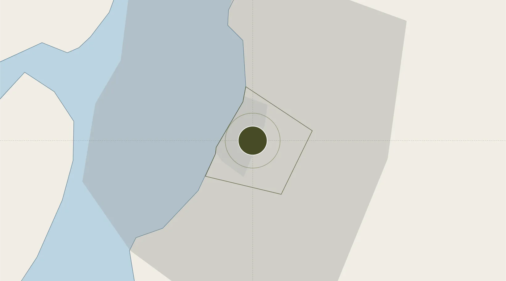
10.6674°, 122.9855°
2 ha
Zone area
26.3 km
Nearest port
12.6 km
Nearest airport

Gateway access

Nearest neighbours — logibook spatial index (haversine) over the source coordinates

Zone profile

Zone type
Specialized Zone
Open Zone Map
Specialization
IT
Open Zone Map
Region
Bacolod
Open Zone Map
Status
Active
Open Zone Map
Management
Private
Open Zone Map
Operator
Sunimoh Incorporated
Open Zone Map
Legal framework
Special Economic Zone Act (Republic Act No. 7916) (as amended by Republic Act No. 8748)
Open Zone Map

Location

Location of ozm-3725
Natural Earth 10m (public domain) · Bacolod · ozm-3725 · 10.67, 122.99GoogleOSMYandex

Nearby Logistics Neighbours

Ports
  1. 1Pulupandan26 km
  2. 2Iloilo44 km
  3. 3San Carlos51 km
  4. 4Toledo78 km
  5. 5Port Capiz108 km
Nearest neighbours — logibook spatial index (haversine) over the source coordinates
Airports
  1. 1Bacolod-Silay International Airport13 km
  2. 2Iloilo International Airport57 km
  3. 3Roxas Airport107 km
  4. 4Evelio Javier Airport116 km
  5. 5Mactan Cebu International Airport116 km
Nearest neighbours — logibook spatial index (haversine) over the source coordinates
Cities
  1. 1Bacolod, Negros5 km
  2. 2La Carlota29 km
  3. 3Iloilo, Panay44 km
  4. 4Ajuy56 km
  5. 5Himamaylan, Negros66 km
Nearest neighbours — logibook spatial index (haversine) over the source coordinates
Trade Zones
  1. 1Bayawan City Information Technology Park0 km
  2. 2Lopues South Square IT Park2 km
  3. 3Lopues East I. T. Center2 km
  4. 4T.U. Building4 km
  5. 5Ayala Bacolod Capitol Corporate Center4 km
Nearest neighbours — logibook spatial index (haversine) over the source coordinates
DatabookThe Record of Consolidated Knowledge
Philippines beyond logistics?
Browse databook

All Sources

Trade ZonesOpen Zone Map
CC BY
Portsthe NGA World Port Index
Public domain (US gov)
AirportsOurAirports
Public domain
LocationsUN/LOCODE
UN/LOCODE — free
← Philippines trade zones