Diversified Zone · Philippines

Naga Agro-Industrial Center Under Development
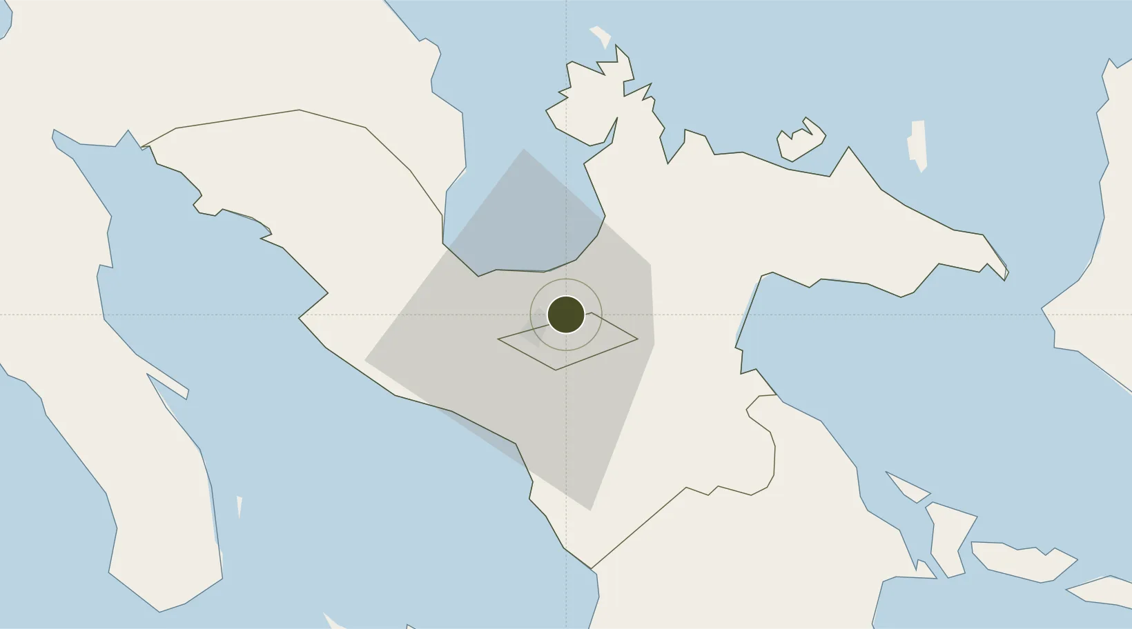
13.6598°, 123.2512°
105 ha
Zone area
61.5 km
Nearest port
8.6 km
Nearest airport

Gateway access

Nearest neighbours — logibook spatial index (haversine) over the source coordinates

Zone profile

Zone type
Diversified Zone
Open Zone Map
Region
Camarines Sur
Open Zone Map
Status
Under Development
Open Zone Map
Management
Private
Open Zone Map
Operator
Pacol Industrial Dev. Corp (PIDC)
Open Zone Map
Legal framework
Special Economic Zone Act (Republic Act No. 7916) (as amended by Republic Act No. 8748)
Open Zone Map

Location

Location of ozm-3182
Natural Earth 10m (public domain) · Camarines Sur · ozm-3182 · 13.66, 123.25GoogleOSMYandex

Nearby Logistics Neighbours

Ports
  1. 1Tabaco62 km
  2. 2Legazpi Port78 km
  3. 3Jose Panganiban93 km
  4. 4Virac108 km
  5. 5Sorsogon112 km
Nearest neighbours — logibook spatial index (haversine) over the source coordinates
Airports
  1. 1Naga Airport9 km
  2. 2Daet Airport60 km
  3. 3Bicol International Airport76 km
  4. 4Virac Airport104 km
  5. 5Moises R. Espinosa Airport149 km
Nearest neighbours — logibook spatial index (haversine) over the source coordinates
Cities
  1. 1Naga, Luzon10 km
  2. 2Tabaco/Legaspi63 km
  3. 3Legaspi Apt, Luzon80 km
  4. 4Gigmoto, Catanduanes123 km
  5. 5Changtu135 km
Nearest neighbours — logibook spatial index (haversine) over the source coordinates
Trade Zones
  1. 1Naga City Industrial Park1 km
  2. 2Camarines Sur IT Park7 km
  3. 3Camarines Sur Agro-Industrial Economic Zone7 km
  4. 4ALDP E-PARK8 km
  5. 5Cam Sur Food Terminal8 km
Nearest neighbours — logibook spatial index (haversine) over the source coordinates
DatabookThe Record of Consolidated Knowledge
Philippines beyond logistics?
Browse databook

All Sources

Trade ZonesOpen Zone Map
CC BY
Portsthe NGA World Port Index
Public domain (US gov)
AirportsOurAirports
Public domain
LocationsUN/LOCODE
UN/LOCODE — free
← Philippines trade zones