Free Trade Zone · Mozambique

Crusse & Jamali Special Economic Zone Under Development

-14.8235°, 40.8286°
1,750 ha
Zone area
25.5 km
Nearest port
39.3 km
Nearest airport

Gateway access

Nearest neighbours — logibook spatial index (haversine) over the source coordinates

Zone profile

Zone type
Free Trade Zone
Open Zone Map
Region
Nampula
Open Zone Map
Status
Under Development
Open Zone Map
Management
Private
Open Zone Map
Operator
Executive Leisure Ltd.
Open Zone Map
Legal framework
Decree 47/2013 of 30 August 2013
Open Zone Map

Location

Location of ozm-2895
Natural Earth 10m (public domain) · Nampula · ozm-2895 · -14.82, 40.83GoogleOSMYandex

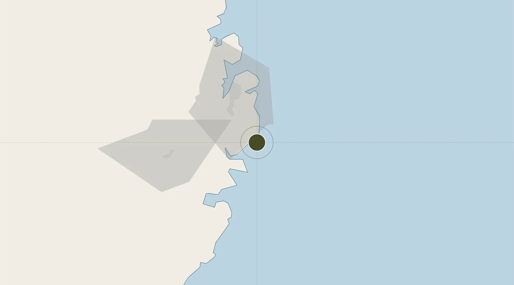
Nearby Logistics Neighbours

Ports
  1. 1Mocambique26 km
  2. 2Nacala37 km
  3. 3Pemba210 km
  4. 4Ibo278 km
  5. 5Pebane395 km
Nearest neighbours — logibook spatial index (haversine) over the source coordinates
Airports
  1. 1Nacala International Airport39 km
  2. 2Nampula Airport169 km
  3. 3Pemba Airport206 km
  4. 4Mueda Airport376 km
  5. 5Mocímboa da Praia Airport388 km
Nearest neighbours — logibook spatial index (haversine) over the source coordinates
Cities
  1. 1Nacala33 km
  2. 2Meconta108 km
  3. 3Coropoa226 km
  4. 4Zambezia246 km
  5. 5Mocímboa da Praia392 km
Nearest neighbours — logibook spatial index (haversine) over the source coordinates
Trade Zones
  1. 1Locone Industrial Free Zone28 km
  2. 2Minheuene Industrial Free Zone31 km
  3. 3Nacala Special Economic Zone & Airport City40 km
  4. 4Mocuba Industrial Free Zone464 km
  5. 5Mtwara Special Economic Zone511 km
Nearest neighbours — logibook spatial index (haversine) over the source coordinates
DatabookThe Record of Consolidated Knowledge
Mozambique beyond logistics?
Browse databook

All Sources

Trade ZonesOpen Zone Map
CC BY
Portsthe NGA World Port Index
Public domain (US gov)
AirportsOurAirports
Public domain
LocationsUN/LOCODE
UN/LOCODE — free
← Mozambique trade zones