Industrial Zone · Vietnam

Vsip I Industrial Zone
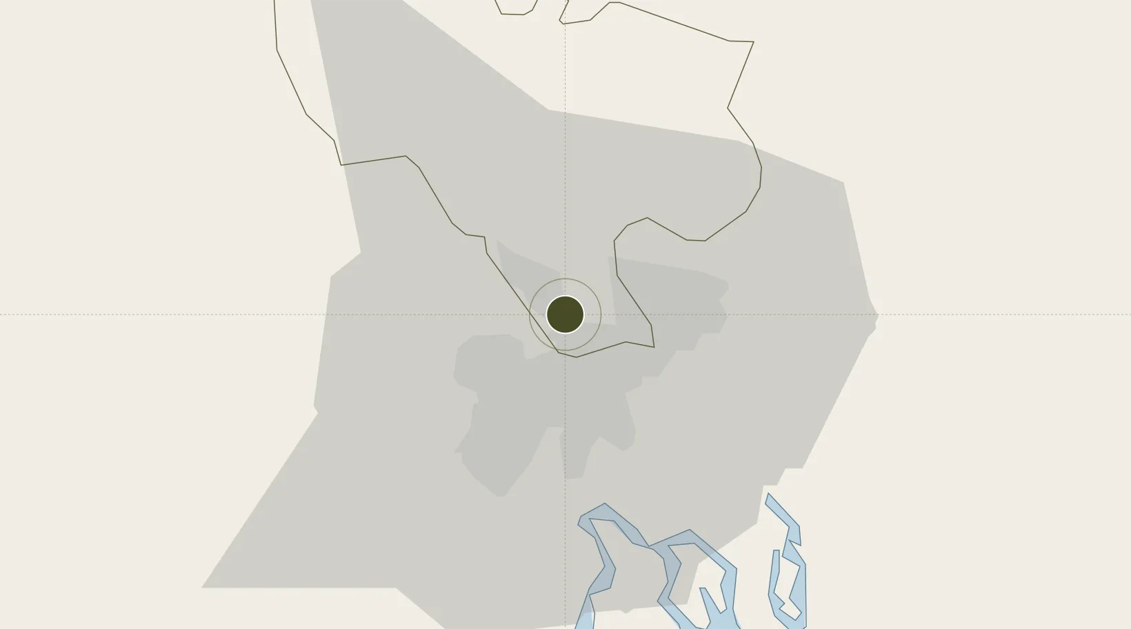
10.9305°, 106.7207°
500 ha
Zone area
13.6 km
Nearest port
14.5 km
Nearest airport

Gateway access

Nearest neighbours — logibook spatial index (haversine) over the source coordinates

Zone profile

Zone type
Industrial Zone
the World Bank SEZ database
Region
Bình Dương
the World Bank SEZ database
Established
1996
the World Bank SEZ database
Management
Public agency
the World Bank SEZ database
Operator
Vietnam Singapore Industrial Park (VSIP)
the World Bank SEZ database
Regulatory authority
Chairmen of Provincial People's Committees
the World Bank SEZ database
Legal framework
Law on Foreign Investment in Vietnam, 1996; Decree No. 36/1997/CP on The Regulation of Industrial, Economic and Export processing zones
the World Bank SEZ database

Location

Location of VNM430
Natural Earth 10m (public domain) · Bình Dương · VNM430 · 10.93, 106.72GoogleOSMYandex

Fiscal & incentives

Corporate tax
20%
the World Bank SEZ database
Tax relief
100% exempt
the World Bank SEZ database
Relief duration
4 years
the World Bank SEZ database
VAT
No exemption
the World Bank SEZ database
Import duty (inputs)
0% exempt
the World Bank SEZ database
Import duty (capex)
100% exempt
the World Bank SEZ database
Profit repatriation
No exemption
the World Bank SEZ database
Capital gains
No exemption
the World Bank SEZ database
Withholding tax
No exemption
the World Bank SEZ database
Min. investment
None
the World Bank SEZ database
Min. export
0%
the World Bank SEZ database
Employment incentive
No exemption
the World Bank SEZ database
Developer incentive
No established framework
the World Bank SEZ database

Nearby Logistics Neighbours

Ports
  1. 1Thanh Hoa14 km
  2. 2Thanh Ho Chi Minh18 km
  3. 3Cat Lai21 km
  4. 4Phu My52 km
  5. 5Vung Tau78 km
Nearest neighbours — logibook spatial index (haversine) over the source coordinates
Airports
  1. 1Tan Son Nhat International Airport15 km
  2. 2Long Thanh International Airport (Under Construction)39 km
  3. 3Can Tho International Airport145 km
  4. 4Lien Khuong Airport201 km
  5. 5Techo International Airport202 km
Nearest neighbours — logibook spatial index (haversine) over the source coordinates
Cities
  1. 1Binh Duong5 km
  2. 2Di An7 km
  3. 3Thu Dau Mot9 km
  4. 4Sai Gon Port11 km
  5. 5ICD TRANSIMEX THU DUC11 km
Nearest neighbours — logibook spatial index (haversine) over the source coordinates
Trade Zones
  1. 1Song Than 2 Industrial Zone6 km
  2. 2Song Than 1 Industrial Zone6 km
  3. 3Tan Dong Hiep B Industrial Zone7 km
  4. 4Dai Dang Industrial Zone10 km
  5. 5Kim Huy Industrial Zone13 km
Nearest neighbours — logibook spatial index (haversine) over the source coordinates
DatabookThe Record of Consolidated Knowledge
Vietnam beyond logistics?
Browse databook

All Sources

Trade Zonesthe World Bank SEZ database
CC BY 4.0
Portsthe NGA World Port Index
Public domain (US gov)
AirportsOurAirports
Public domain
LocationsUN/LOCODE
UN/LOCODE — free
← Vietnam trade zones