UN/LOCODE hub · United States
USZBC

Bala-Cynwyd

40.0167°, -75.2333°
9,299
Population
2
Transport functions

Transport Functions

Rail
Road
UN/LOCODE

Hub Profile

Place type
Populated place
GeoNames
Region
Pennsylvania
GeoNames
Population
9,299
GeoNames
Time zone
America/New_York
GeoNames
Elevation
93 m
GeoNames

Location

Location of USZBC
Natural Earth 10m (public domain) · Pennsylvania · USZBC · 40.02, -75.23GoogleOSMYandex

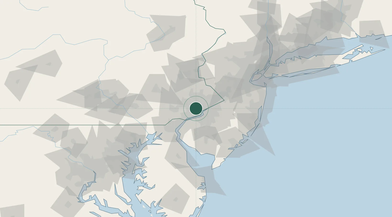
Nearby Logistics Neighbours

Cities
  1. 1Manayunk1 km
  2. 2Gladwyne3 km
  3. 3Wynnewood3 km
  4. 4Ardmore5 km
  5. 5Haverford5 km
Nearest neighbours — logibook spatial index (haversine) over the source coordinates
Ports
  1. 1Philadelphia11 km
  2. 2Camden11 km
  3. 3Gloucester16 km
  4. 4Paulsboro19 km
  5. 5Chester21 km
Nearest neighbours — logibook spatial index (haversine) over the source coordinates
Airports
  1. 1Philadelphia International Airport16 km
  2. 2Northeast Philadelphia Airport20 km
  3. 3Trenton Mercer Airport46 km
  4. 4Wilmington Airport49 km
  5. 5Mc Guire Air Force Base55 km
Nearest neighbours — logibook spatial index (haversine) over the source coordinates
Trade Zones
  1. 1FTZ No. 035 Philadelphia3 km
  2. 2FTZ No. 099 Wilmington40 km
  3. 3FTZ No. 200 Mercer County44 km
  4. 4FTZ No. 142 Salem Millville70 km
  5. 5FTZ No. 235 Lakewood85 km
Nearest neighbours — logibook spatial index (haversine) over the source coordinates
DatabookThe Record of Consolidated Knowledge
United States beyond logistics?
Browse databook

All Sources

LocationsUN/LOCODE
UN/LOCODE — free
LocationsGeoNames
CC BY 4.0
Portsthe NGA World Port Index
Public domain (US gov)
AirportsOurAirports
Public domain
Trade Zonesthe World Bank SEZ database
CC BY 4.0
Trade ZonesOpen Zone Map
CC BY
← United States locations