UN/LOCODE hub · Russia
RUBRK

Lomonosov

59.9325°, 29.6960°
42,505
Population
3
Transport functions

Transport Functions

Port
Rail
Road
UN/LOCODE

Hub Profile

Place type
Populated place
GeoNames
Region
St.-Petersburg
GeoNames
Population
42,505
GeoNames
Time zone
Europe/Moscow
GeoNames
Elevation
30 m
GeoNames
Logistics facilities
1
UN/LOCODE

Location

Location of RUBRK
Natural Earth 10m (public domain) · St.-Petersburg · RUBRK · 59.93, 29.70GoogleOSMYandex

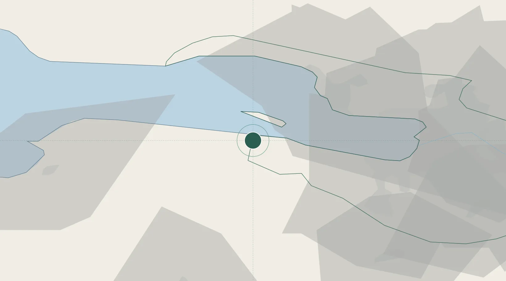
Nearby Logistics Neighbours

Cities
  1. 1Bronka Port2 km
  2. 2Kronshtadt9 km
  3. 3Kronstadt9 km
  4. 4Gorskaya20 km
  5. 5Sestroretsk23 km
Nearest neighbours — logibook spatial index (haversine) over the source coordinates
Ports
  1. 1Lomonosov4 km
  2. 2Kronshtadt8 km
  3. 3Primorsk76 km
  4. 4Ust Luga83 km
  5. 5Gavan Vysotsk98 km
Nearest neighbours — logibook spatial index (haversine) over the source coordinates
Airports
  1. 1Levashovo Air Base33 km
  2. 2Pulkovo Airport35 km
  3. 3Pushkin Airport45 km
  4. 4Pribylovo Naval Air Base79 km
  5. 5Lappeenranta Airport150 km
Nearest neighbours — logibook spatial index (haversine) over the source coordinates
Trade Zones
  1. 1St Petersburg Technology Innovative Special Economic Zone20 km
  2. 2Port of Sillamäe125 km
  3. 3Free Zone of Lappeenranta151 km
  4. 4Port of Hamina-Kotka164 km
  5. 5Moglino Special Economic Zone - Industrial258 km
Nearest neighbours — logibook spatial index (haversine) over the source coordinates
DatabookThe Record of Consolidated Knowledge
Russia beyond logistics?
Browse databook

All Sources

LocationsUN/LOCODE
UN/LOCODE — free
LocationsGeoNames
CC BY 4.0
Portsthe NGA World Port Index
Public domain (US gov)
AirportsOurAirports
Public domain
Trade Zonesthe World Bank SEZ database
CC BY 4.0
Trade ZonesOpen Zone Map
CC BY
← Russia locations