UN/LOCODE hub · Russia
RUABK

Abinsk

44.8667°, 38.1500°
34,668
Population
3
Transport functions

Transport Functions

Port
Rail
Road
UN/LOCODE

Hub Profile

Place type
Provincial seat
GeoNames
Region
Krasnodar Krai
GeoNames
Population
34,668
GeoNames
Time zone
Europe/Moscow
GeoNames
Elevation
33 m
GeoNames

Location

Location of RUABK
Natural Earth 10m (public domain) · Krasnodar Krai · RUABK · 44.87, 38.15GoogleOSMYandex

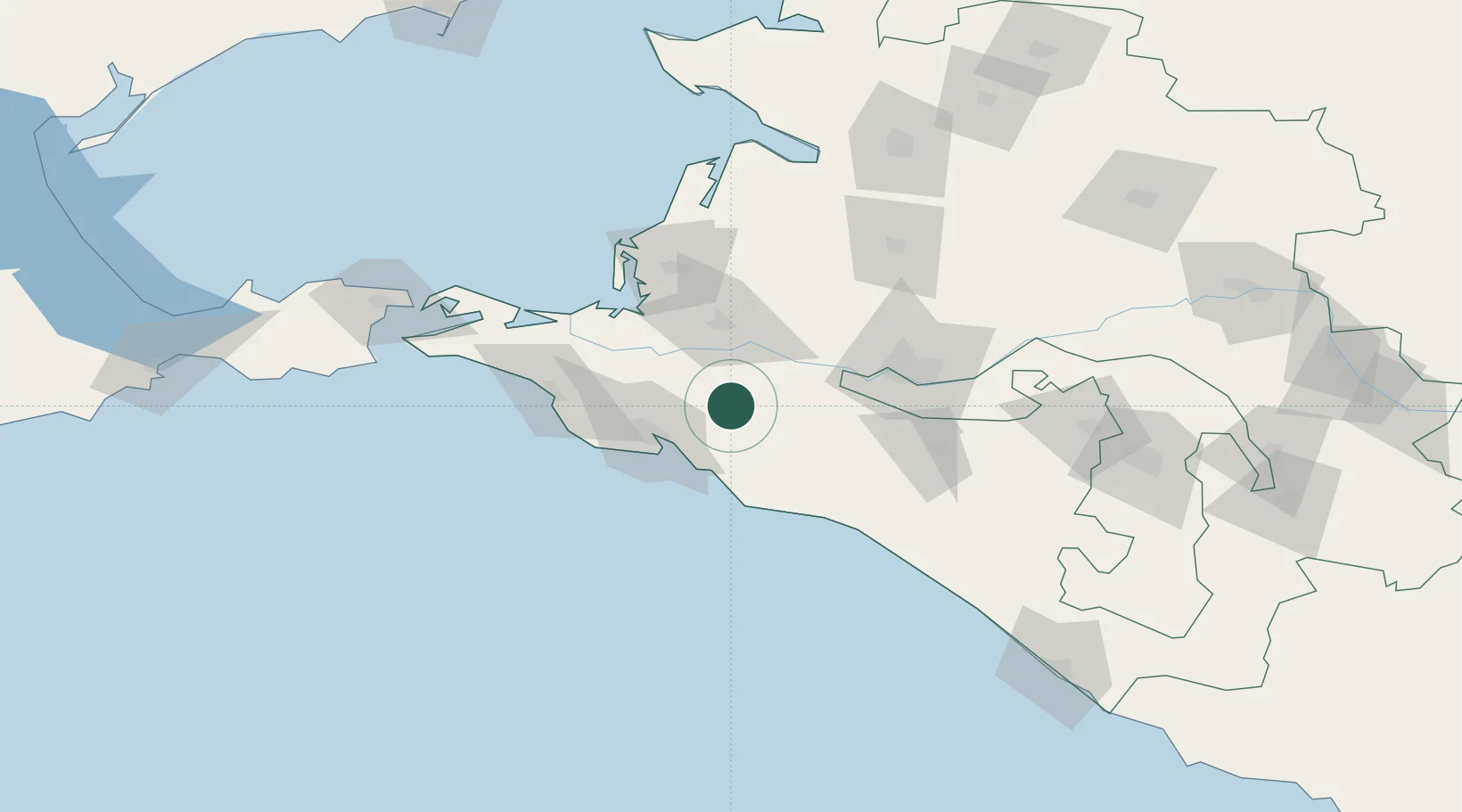
Nearby Logistics Neighbours

Cities
  1. 1Krymsk16 km
  2. 2Novorossiysk35 km
  3. 3Kirillovka36 km
  4. 4Myskhako38 km
  5. 5Severskaya41 km
Nearest neighbours — logibook spatial index (haversine) over the source coordinates
Ports
  1. 1Novorossiysk33 km
  2. 2Gelendzhik36 km
  3. 3Anapa66 km
  4. 4Temryuk83 km
  5. 5Tuapse112 km
Nearest neighbours — logibook spatial index (haversine) over the source coordinates
Airports
  1. 1Krymsk Air Base16 km
  2. 2Gelendzhik Airport34 km
  3. 3Anapa Vityazevo Airport65 km
  4. 4Krasnodar Central Air Base67 km
  5. 5Krasnodar Pashkovsky International Airport83 km
Nearest neighbours — logibook spatial index (haversine) over the source coordinates
Trade Zones
  1. 1Azov Economic Zone251 km
  2. 2Special Economic Zone Donetsk350 km
  3. 3Kulevi Free Industrial Zone403 km
  4. 4Poti Free Industrial Zone411 km
  5. 5Samsun Free Zone422 km
Nearest neighbours — logibook spatial index (haversine) over the source coordinates
DatabookThe Record of Consolidated Knowledge
Russia beyond logistics?
Browse databook

All Sources

LocationsUN/LOCODE
UN/LOCODE — free
LocationsGeoNames
CC BY 4.0
Portsthe NGA World Port Index
Public domain (US gov)
AirportsOurAirports
Public domain
Trade Zonesthe World Bank SEZ database
CC BY 4.0
Trade ZonesOpen Zone Map
CC BY
← Russia locations