UN/LOCODE hub · Norway
NOVOL

Voldafjorden

62.1667°, 6.1000°
2
Transport functions

Transport Functions

Rail
Road
UN/LOCODE

Hub Profile

Region
15
GeoNames

Location

Location of NOVOL
Natural Earth 10m (public domain) · 15 · NOVOL · 62.17, 6.10GoogleOSMYandex

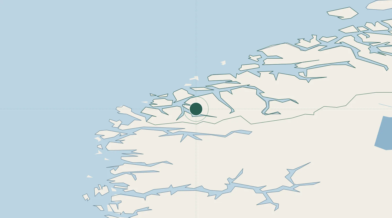
Nearby Logistics Neighbours

Cities
  1. 1Ørsta2 km
  2. 2Volda5 km
  3. 3Vartdal15 km
  4. 4Rovde18 km
  5. 5Hjørungavåg21 km
Nearest neighbours — logibook spatial index (haversine) over the source coordinates
Ports
  1. 1Orstav3 km
  2. 2Hareid23 km
  3. 3Moldtustranda28 km
  4. 4Alesund34 km
  5. 5Maloy57 km
Nearest neighbours — logibook spatial index (haversine) over the source coordinates
Airports
  1. 1Ørsta-Volda Airport, Hovden2 km
  2. 2Sandane Airport, Anda37 km
  3. 3Ålesund Airport44 km
  4. 4Florø Airport86 km
  5. 5Molde Airport, Årø88 km
Nearest neighbours — logibook spatial index (haversine) over the source coordinates
Trade Zones
  1. 1Gothenburg Boundless Customs Warehouse589 km
  2. 2Jönköping Free Zone660 km
  3. 3Freeport of Copenhagen- Nordhavn808 km
  4. 4MTS Malmö Transport and Spedition832 km
  5. 5Freeport of Kiel903 km
Nearest neighbours — logibook spatial index (haversine) over the source coordinates
DatabookThe Record of Consolidated Knowledge
Norway beyond logistics?
Browse databook

All Sources

LocationsUN/LOCODE
UN/LOCODE — free
Portsthe NGA World Port Index
Public domain (US gov)
AirportsOurAirports
Public domain
Trade Zonesthe World Bank SEZ database
CC BY 4.0
Trade ZonesOpen Zone Map
CC BY
← Norway locations