UN/LOCODE hub · Norway
NOHJO

Hjørungavåg

62.3500°, 6.0667°
2
Transport functions

Transport Functions

Port
Road
UN/LOCODE

Hub Profile

Region
15
GeoNames

Location

Location of NOHJO
Natural Earth 10m (public domain) · 15 · NOHJO · 62.35, 6.07GoogleOSMYandex

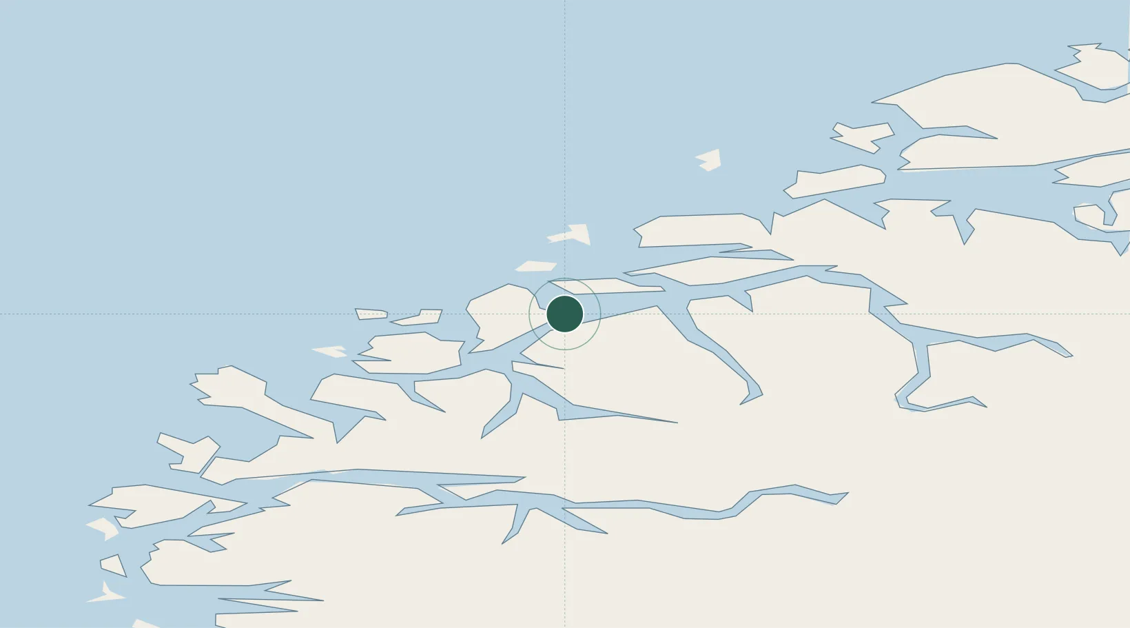
Nearby Logistics Neighbours

Cities
  1. 1Liavåg0 km
  2. 2Liavåg3 km
  3. 3Hareid3 km
  4. 4Vartdal6 km
  5. 5Langevåg - Sula12 km
Nearest neighbours — logibook spatial index (haversine) over the source coordinates
Ports
  1. 1Hareid3 km
  2. 2Alesund14 km
  3. 3Orstav17 km
  4. 4Moldtustranda22 km
  5. 5Maloy68 km
Nearest neighbours — logibook spatial index (haversine) over the source coordinates
Airports
  1. 1Ørsta-Volda Airport, Hovden19 km
  2. 2Ålesund Airport24 km
  3. 3Sandane Airport, Anda58 km
  4. 4Molde Airport, Årø75 km
  5. 5Florø Airport101 km
Nearest neighbours — logibook spatial index (haversine) over the source coordinates
Trade Zones
  1. 1Gothenburg Boundless Customs Warehouse607 km
  2. 2Jönköping Free Zone676 km
  3. 3Freeport of Copenhagen- Nordhavn826 km
  4. 4MTS Malmö Transport and Spedition850 km
  5. 5Freeport of Kiel923 km
Nearest neighbours — logibook spatial index (haversine) over the source coordinates
DatabookThe Record of Consolidated Knowledge
Norway beyond logistics?
Browse databook

All Sources

LocationsUN/LOCODE
UN/LOCODE — free
Portsthe NGA World Port Index
Public domain (US gov)
AirportsOurAirports
Public domain
Trade Zonesthe World Bank SEZ database
CC BY 4.0
Trade ZonesOpen Zone Map
CC BY
← Norway locations