UN/LOCODE hub · Norway
NOHRV

Hordvik

60.5167°, 5.3000°
2
Transport functions

Transport Functions

Port
Road
UN/LOCODE

Hub Profile

Place type
Populated place
GeoNames
Region
Vestland
GeoNames
Time zone
Europe/Oslo
GeoNames
Elevation
40 m
GeoNames

Location

Location of NOHRV
Natural Earth 10m (public domain) · Vestland · NOHRV · 60.52, 5.30GoogleOSMYandex

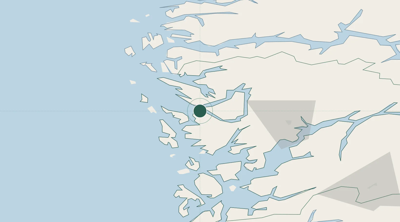
Nearby Logistics Neighbours

Cities
  1. 1Flatoy3 km
  2. 2Flatøy3 km
  3. 3Frekhaug4 km
  4. 4Mjolkeraen5 km
  5. 5Lonevåg10 km
Nearest neighbours — logibook spatial index (haversine) over the source coordinates
Ports
  1. 1Bergen13 km
  2. 2Brattholmen20 km
  3. 3Haakonsvern21 km
  4. 4Vaksdal24 km
  5. 5Stura27 km
Nearest neighbours — logibook spatial index (haversine) over the source coordinates
Airports
  1. 1Bergen Airport, Flesland25 km
  2. 2Stord Airport, Sørstokken81 km
  3. 3Førde Airport, Bringeland100 km
  4. 4Florø Airport120 km
  5. 5Sogndal Airport, Haukåsen122 km
Nearest neighbours — logibook spatial index (haversine) over the source coordinates
Trade Zones
  1. 1Gothenburg Boundless Customs Warehouse485 km
  2. 2Freeport of Copenhagen- Nordhavn684 km
  3. 3MTS Malmö Transport and Spedition712 km
  4. 4North Eastern Enterprise Zone741 km
  5. 5Freeport of Kiel746 km
Nearest neighbours — logibook spatial index (haversine) over the source coordinates
DatabookThe Record of Consolidated Knowledge
Norway beyond logistics?
Browse databook

All Sources

LocationsUN/LOCODE
UN/LOCODE — free
Portsthe NGA World Port Index
Public domain (US gov)
AirportsOurAirports
Public domain
Trade Zonesthe World Bank SEZ database
CC BY 4.0
Trade ZonesOpen Zone Map
CC BY
← Norway locations