UN/LOCODE hub · Italy
ITAGP

Agropoli

40.3500°, 14.9833°
17,335
Population
1
Transport functions

Transport Functions

Port
UN/LOCODE

Hub Profile

Place type
District seat
GeoNames
Region
Campania
GeoNames
Population
17,335
GeoNames
Time zone
Europe/Rome
GeoNames
Elevation
24 m
GeoNames

Location

Location of ITAGP
Natural Earth 10m (public domain) · Campania · ITAGP · 40.35, 14.98GoogleOSMYandex

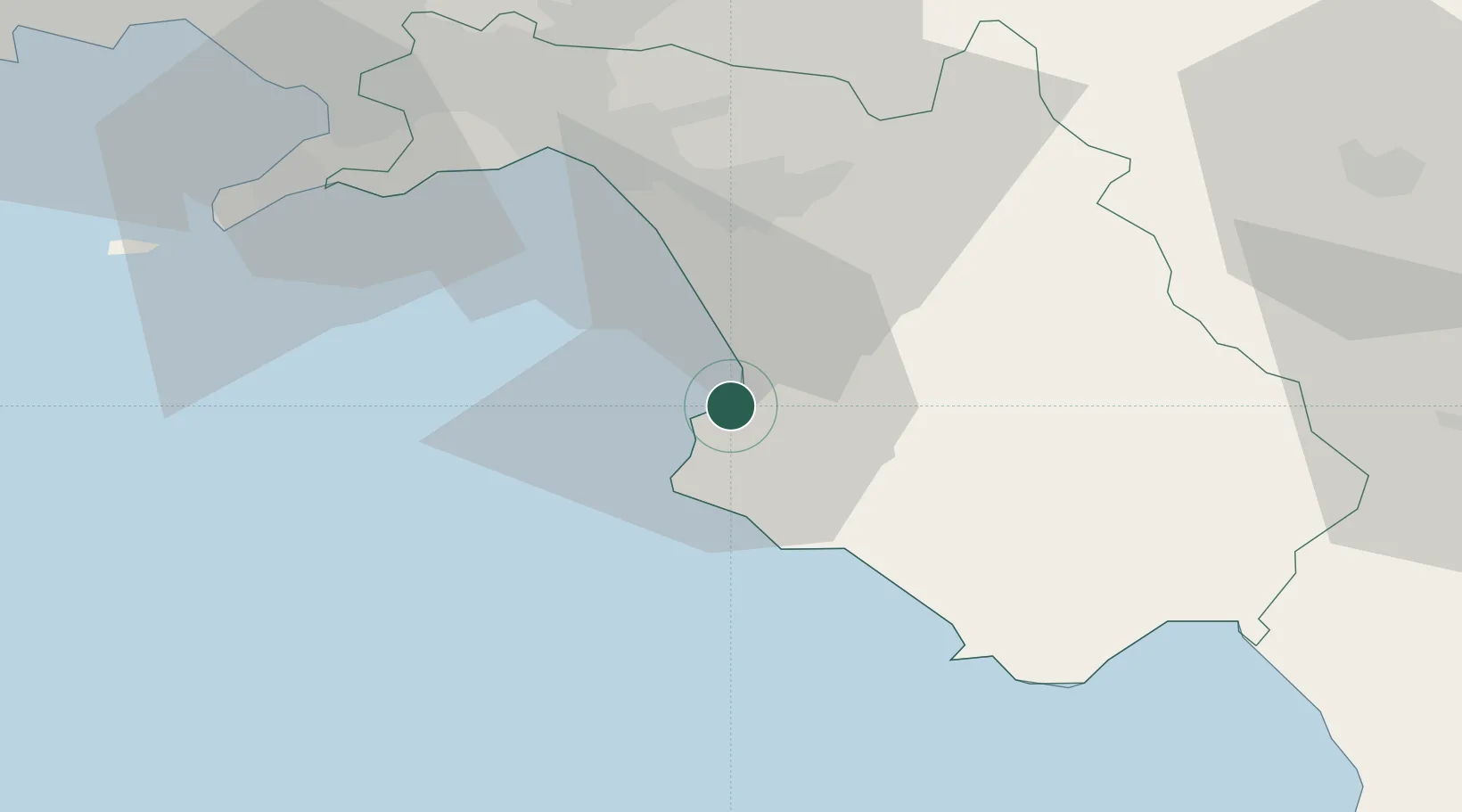
Nearby Logistics Neighbours

Cities
  1. 1Prignano Cilento7 km
  2. 2Santa Maria di Castellabate8 km
  3. 3Giungano11 km
  4. 4Acciaroli19 km
  5. 5Serre29 km
Nearest neighbours — logibook spatial index (haversine) over the source coordinates
Ports
  1. 1Salerno40 km
  2. 2Castellammare Di Stabia58 km
  3. 3Torre Annunziata63 km
  4. 4Torre Del Greco71 km
  5. 5Napoli80 km
Nearest neighbours — logibook spatial index (haversine) over the source coordinates
Airports
  1. 1Salerno Costa d'Amalfi Airport31 km
  2. 2Naples International Airport84 km
  3. 3Grazzanise Air Base110 km
  4. 4Foggia Gino Lisa Airport129 km
  5. 5Amendola Air Base146 km
Nearest neighbours — logibook spatial index (haversine) over the source coordinates
Trade Zones
  1. 1Basilicata Special Economic Zone51 km
  2. 2Puglia (Apulia) Special Economic Zone Area90 km
  3. 3Campania Special Economic Zone (Naples and Salerno)120 km
  4. 4Calabria Special Economic Zone158 km
  5. 5Ionian Special Economic Zone173 km
Nearest neighbours — logibook spatial index (haversine) over the source coordinates
DatabookThe Record of Consolidated Knowledge
Italy beyond logistics?
Browse databook

All Sources

LocationsUN/LOCODE
UN/LOCODE — free
LocationsGeoNames
CC BY 4.0
Portsthe NGA World Port Index
Public domain (US gov)
AirportsOurAirports
Public domain
Trade Zonesthe World Bank SEZ database
CC BY 4.0
Trade ZonesOpen Zone Map
CC BY
← Italy locations