UN/LOCODE hub · Italy
ITRRS

Serre

40.5667°, 15.1833°
2,075
Population
1
Transport functions

Transport Functions

Multimodal
UN/LOCODE

Hub Profile

Place type
District seat
GeoNames
Region
Campania
GeoNames
Population
2,075
GeoNames
Time zone
Europe/Rome
GeoNames
Elevation
200 m
GeoNames

Location

Location of ITRRS
Natural Earth 10m (public domain) · Campania · ITRRS · 40.57, 15.18GoogleOSMYandex

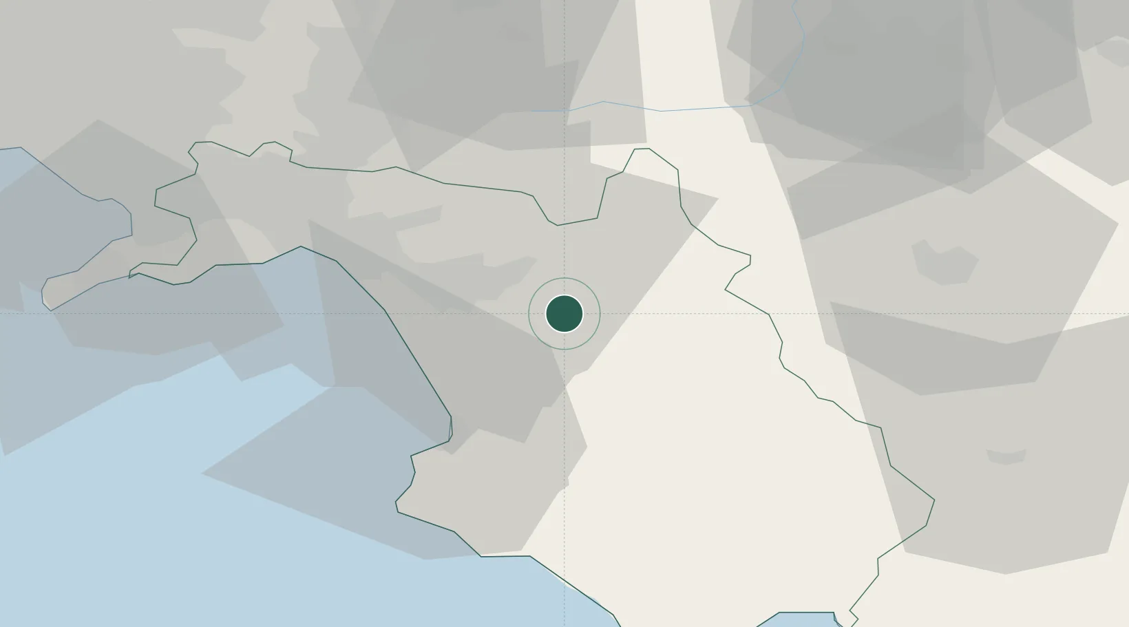
Nearby Logistics Neighbours

Cities
  1. 1Buccino18 km
  2. 2Giungano20 km
  3. 3Polla26 km
  4. 4Pontecagnano Faiano28 km
  5. 5Prignano Cilento28 km
Nearest neighbours — logibook spatial index (haversine) over the source coordinates
Ports
  1. 1Salerno38 km
  2. 2Castellammare Di Stabia62 km
  3. 3Torre Annunziata65 km
  4. 4Torre Del Greco73 km
  5. 5Napoli82 km
Nearest neighbours — logibook spatial index (haversine) over the source coordinates
Airports
  1. 1Salerno Costa d'Amalfi Airport24 km
  2. 2Naples International Airport83 km
  3. 3Foggia Gino Lisa Airport101 km
  4. 4Grazzanise Air Base108 km
  5. 5Amendola Air Base117 km
Nearest neighbours — logibook spatial index (haversine) over the source coordinates
DatabookThe Record of Consolidated Knowledge
Italy beyond logistics?
Browse databook

All Sources

LocationsUN/LOCODE
UN/LOCODE — free
LocationsGeoNames
CC BY 4.0
Portsthe NGA World Port Index
Public domain (US gov)
AirportsOurAirports
Public domain
Trade Zonesthe World Bank SEZ database
CC BY 4.0
Trade ZonesOpen Zone Map
CC BY
← Italy locations