UN/LOCODE hub · India
INMEC

ECTN SEZ/Madurai-I

9.9333°, 78.1167°
2
Transport functions

Transport Functions

Road
Multimodal
UN/LOCODE

Hub Profile

Region
TN
GeoNames

Location

Location of INMEC
Natural Earth 10m (public domain) · TN · INMEC · 9.93, 78.12GoogleOSMYandex

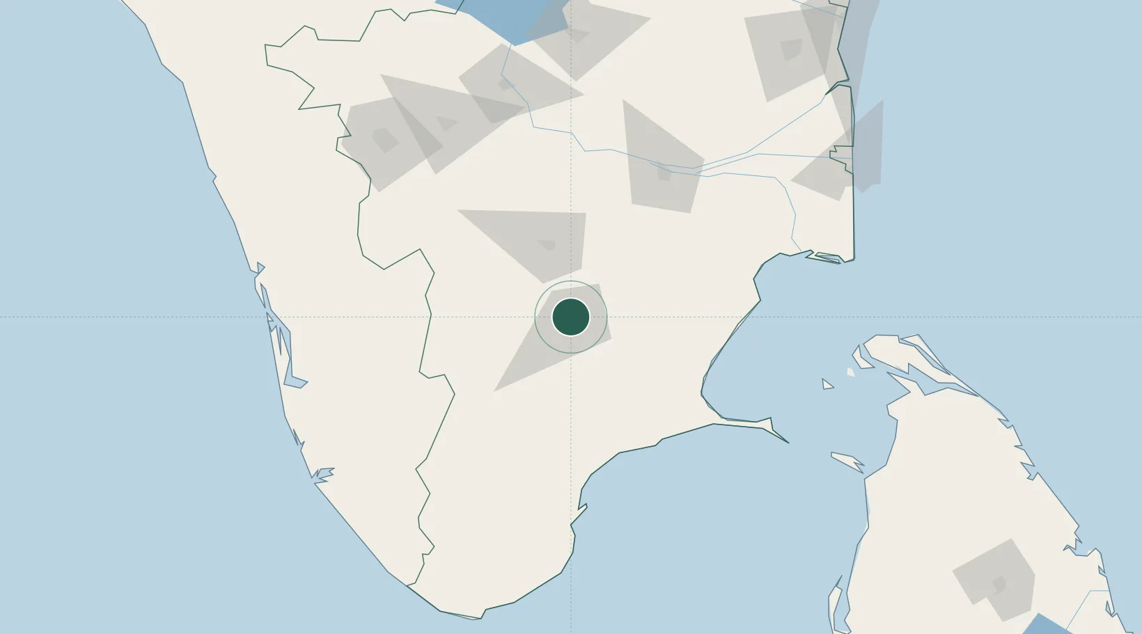
Nearby Logistics Neighbours

Cities
  1. 1ECTN SEZ/Madurai-II0 km
  2. 2RTPL SEZ/Madurai0 km
  3. 3Kern Icd/Madurai3 km
  4. 4Madurai7 km
  5. 5Ambatturai (Ambathurai)42 km
Nearest neighbours — logibook spatial index (haversine) over the source coordinates
Ports
  1. 1Tuticorin126 km
  2. 2Quilon (Kollam)205 km
  3. 3Trivandrum206 km
  4. 4Kochi (Cochin)206 km
  5. 5Nagappattinam211 km
Nearest neighbours — logibook spatial index (haversine) over the source coordinates
Airports
  1. 1Madurai Airport11 km
  2. 2Tiruchirappalli International Airport113 km
  3. 3Tuticorin Airport135 km
  4. 4Coimbatore International Airport169 km
  5. 5Cochin International Airport189 km
Nearest neighbours — logibook spatial index (haversine) over the source coordinates
Trade Zones
  1. 1Span Ventures167 km
  2. 2Rathinam Techzone167 km
  3. 3Aspen Karumathamapatti Special Economic Zone (Formerly Aspen)169 km
  4. 4AMRL International Tech City Ltd.172 km
  5. 5M s. Smart City (Kochi) Infrastructure Limited192 km
Nearest neighbours — logibook spatial index (haversine) over the source coordinates
DatabookThe Record of Consolidated Knowledge
India beyond logistics?
Browse databook

All Sources

LocationsUN/LOCODE
UN/LOCODE — free
Portsthe NGA World Port Index
Public domain (US gov)
AirportsOurAirports
Public domain
Trade Zonesthe World Bank SEZ database
CC BY 4.0
Trade ZonesOpen Zone Map
CC BY
← India locations