UN/LOCODE hub · India
INIXM

Madurai

9.8768°, 78.0968°
1,465,625
Population
4
Transport functions

Transport Functions

Port
Road
Airport
Multimodal
UN/LOCODE

Hub Profile

Place type
Provincial seat
GeoNames
Region
Tamil Nadu
GeoNames
Population
1,465,625
GeoNames
Time zone
Asia/Kolkata
GeoNames
Elevation
139 m
GeoNames
Logistics facilities
2
UN/LOCODE

Location

Location of INIXM
Natural Earth 10m (public domain) · Tamil Nadu · INIXM · 9.88, 78.10GoogleOSMYandex

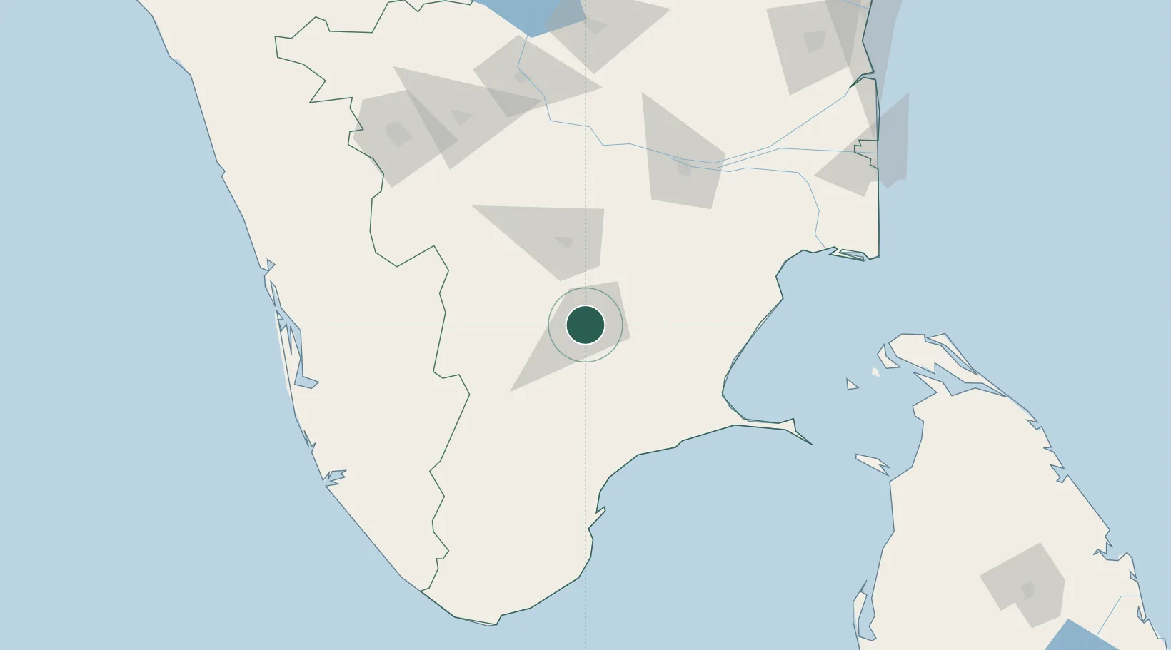
Nearby Logistics Neighbours

Cities
  1. 1Kern Icd/Madurai5 km
  2. 2ECTN SEZ/Madurai-II7 km
  3. 3RTPL SEZ/Madurai7 km
  4. 4ECTN SEZ/Madurai-I7 km
  5. 5Ambatturai (Ambathurai)47 km
Nearest neighbours — logibook spatial index (haversine) over the source coordinates
Ports
  1. 1Tuticorin120 km
  2. 2Trivandrum200 km
  3. 3Quilon (Kollam)200 km
  4. 4Kochi (Cochin)204 km
  5. 5Kankesanturai214 km
Nearest neighbours — logibook spatial index (haversine) over the source coordinates
Airports
  1. 1Madurai Airport5 km
  2. 2Tiruchirappalli International Airport120 km
  3. 3Tuticorin Airport128 km
  4. 4Coimbatore International Airport172 km
  5. 5Cochin International Airport188 km
Nearest neighbours — logibook spatial index (haversine) over the source coordinates
Trade Zones
  1. 1AMRL International Tech City Ltd.165 km
  2. 2Span Ventures169 km
  3. 3Rathinam Techzone170 km
  4. 4Aspen Karumathamapatti Special Economic Zone (Formerly Aspen)172 km
  5. 5M s. Smart City (Kochi) Infrastructure Limited190 km
Nearest neighbours — logibook spatial index (haversine) over the source coordinates
DatabookThe Record of Consolidated Knowledge
India beyond logistics?
Browse databook

All Sources

LocationsUN/LOCODE
UN/LOCODE — free
LocationsGeoNames
CC BY 4.0
Portsthe NGA World Port Index
Public domain (US gov)
AirportsOurAirports
Public domain
Trade Zonesthe World Bank SEZ database
CC BY 4.0
Trade ZonesOpen Zone Map
CC BY
← India locations