UN/LOCODE hub · India
INCJB

Coimbatore

11.0426°, 77.0102°
2,136,916
Population
2
Transport functions

Transport Functions

Airport
Multimodal
UN/LOCODE

Hub Profile

Place type
Populated place
GeoNames
Region
Tamil Nadu
GeoNames
Population
2,136,916
GeoNames
Time zone
Asia/Kolkata
GeoNames
Elevation
411 m
GeoNames
Logistics facilities
2
UN/LOCODE

Location

Location of INCJB
Natural Earth 10m (public domain) · Tamil Nadu · INCJB · 11.04, 77.01GoogleOSMYandex

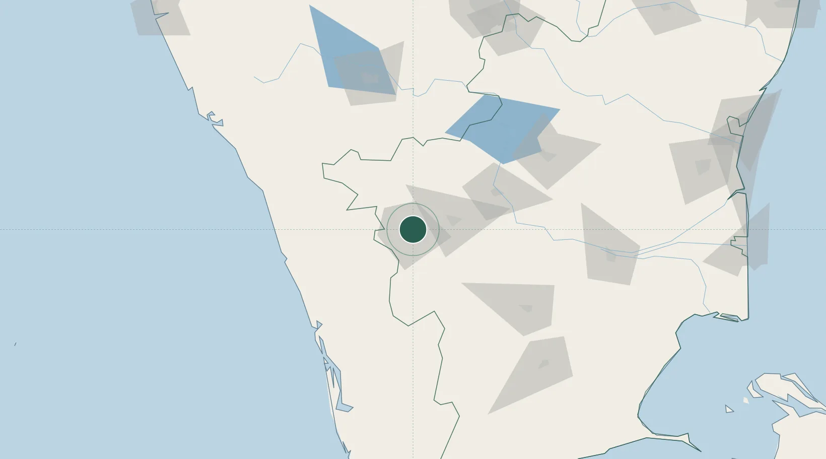
Nearby Logistics Neighbours

Cities
  1. 1Singanallur5 km
  2. 2SE&C LTD-SEZ/Coimbatore7 km
  3. 3TDPL SEZ/Coimbatore7 km
  4. 4ECTN SEZ/Coimbatore7 km
  5. 5SVPL SEZ/Coimbatore7 km
Nearest neighbours — logibook spatial index (haversine) over the source coordinates
Ports
  1. 1Beypore133 km
  2. 2Calicut (Kozhikode)138 km
  3. 3Kochi (Cochin)147 km
  4. 4Azhikal (Azhikkal)211 km
  5. 5Quilon (Kollam)246 km
Nearest neighbours — logibook spatial index (haversine) over the source coordinates
Airports
  1. 1Coimbatore International Airport4 km
  2. 2Calicut International Airport116 km
  3. 3Cochin International Airport119 km
  4. 4Mysore Airport138 km
  5. 5Salem Airport142 km
Nearest neighbours — logibook spatial index (haversine) over the source coordinates
Trade Zones
  1. 1Rathinam Techzone13 km
  2. 2Span Ventures13 km
  3. 3Aspen Karumathamapatti Special Economic Zone (Formerly Aspen)20 km
  4. 4Kinfra (Food Processing) SEZ Kakkancherry123 km
  5. 5Kerala State Information Technology Infrastructure Limited130 km
Nearest neighbours — logibook spatial index (haversine) over the source coordinates
DatabookThe Record of Consolidated Knowledge
India beyond logistics?
Browse databook

All Sources

LocationsUN/LOCODE
UN/LOCODE — free
LocationsGeoNames
CC BY 4.0
Portsthe NGA World Port Index
Public domain (US gov)
AirportsOurAirports
Public domain
Trade Zonesthe World Bank SEZ database
CC BY 4.0
Trade ZonesOpen Zone Map
CC BY
← India locations