UN/LOCODE hub · India
INCBT

TDPL SEZ/Coimbatore

11.0000°, 76.9667°
2
Transport functions

Transport Functions

Road
Multimodal
UN/LOCODE

Hub Profile

Region
TN
GeoNames

Location

Location of INCBT
Natural Earth 10m (public domain) · TN · INCBT · 11.00, 76.97GoogleOSMYandex

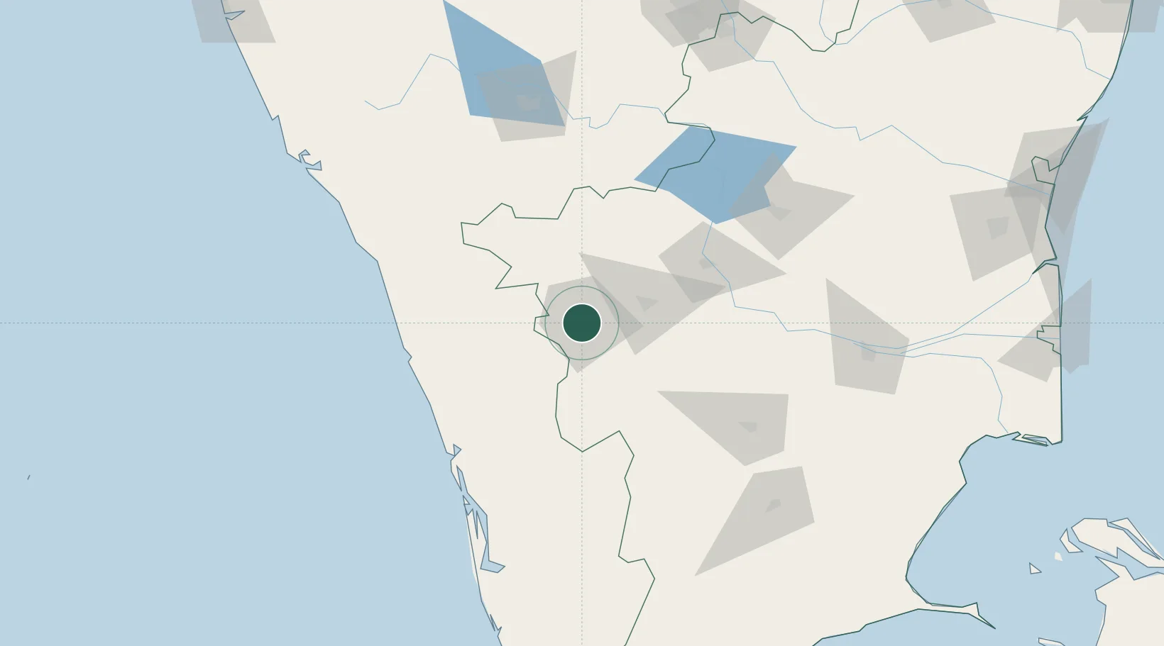
Nearby Logistics Neighbours

Cities
  1. 1SE&C LTD-SEZ/Coimbatore0 km
  2. 2ECTN SEZ/Coimbatore0 km
  3. 3SVPL SEZ/Coimbatore0 km
  4. 4Singanallur4 km
  5. 5Coimbatore7 km
Nearest neighbours — logibook spatial index (haversine) over the source coordinates
Ports
  1. 1Beypore129 km
  2. 2Calicut (Kozhikode)134 km
  3. 3Kochi (Cochin)140 km
  4. 4Azhikal (Azhikkal)209 km
  5. 5Quilon (Kollam)240 km
Nearest neighbours — logibook spatial index (haversine) over the source coordinates
Airports
  1. 1Coimbatore International Airport9 km
  2. 2Calicut International Airport111 km
  3. 3Cochin International Airport113 km
  4. 4Mysore Airport141 km
  5. 5Salem Airport148 km
Nearest neighbours — logibook spatial index (haversine) over the source coordinates
DatabookThe Record of Consolidated Knowledge
India beyond logistics?
Browse databook

All Sources

LocationsUN/LOCODE
UN/LOCODE — free
Portsthe NGA World Port Index
Public domain (US gov)
AirportsOurAirports
Public domain
Trade Zonesthe World Bank SEZ database
CC BY 4.0
Trade ZonesOpen Zone Map
CC BY
← India locations