UN/LOCODE hub · Croatia
HRTNR

Tunarica

44.9667°, 14.1000°
2
Transport functions

Transport Functions

Port
Road
UN/LOCODE

Location

Location of HRTNR
Natural Earth 10m (public domain) · Istarska · HRTNR · 44.97, 14.10GoogleOSMYandex

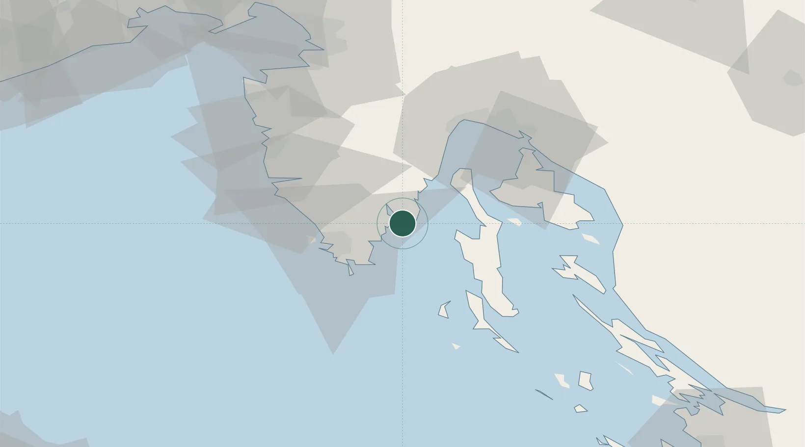
Nearby Logistics Neighbours

Cities
  1. 1Koromacno1 km
  2. 2Rasa11 km
  3. 3Rabac14 km
  4. 4Porozina19 km
  5. 5Galizana19 km
Nearest neighbours — logibook spatial index (haversine) over the source coordinates
Ports
  1. 1Zaliv Rasa10 km
  2. 2Pula25 km
  3. 3Rovinj39 km
  4. 4Omisalj45 km
  5. 5Rijeka Luka48 km
Nearest neighbours — logibook spatial index (haversine) over the source coordinates
Airports
  1. 1Pula Airport16 km
  2. 2Rijeka Airport46 km
  3. 3Portorož Airport68 km
  4. 4Trieste Airport108 km
  5. 5Zadar Airport139 km
Nearest neighbours — logibook spatial index (haversine) over the source coordinates
Trade Zones
  1. 1Port of Pula Free Zone24 km
  2. 2Port of Rijeka Free Zone28 km
  3. 3Free Zone Kukuljanovo52 km
  4. 4Free Port of Trieste80 km
  5. 5Free Port of Venice149 km
Nearest neighbours — logibook spatial index (haversine) over the source coordinates
DatabookThe Record of Consolidated Knowledge
Croatia beyond logistics?
Browse databook

All Sources

LocationsUN/LOCODE
UN/LOCODE — free
Portsthe NGA World Port Index
Public domain (US gov)
AirportsOurAirports
Public domain
Trade Zonesthe World Bank SEZ database
CC BY 4.0
Trade ZonesOpen Zone Map
CC BY
← Croatia locations