UN/LOCODE hub · France
FRL83

La Moutonne

43.1167°, 6.0667°
1
Transport functions

Transport Functions

Port
UN/LOCODE

Hub Profile

Place type
Populated place
GeoNames
Region
Provence-Alpes-Côte d'Azur
GeoNames
Time zone
Europe/Paris
GeoNames
Elevation
58 m
GeoNames

Location

Location of FRL83
Natural Earth 10m (public domain) · Provence-Alpes-Côte d'Azur · FRL83 · 43.12, 6.07GoogleOSMYandex

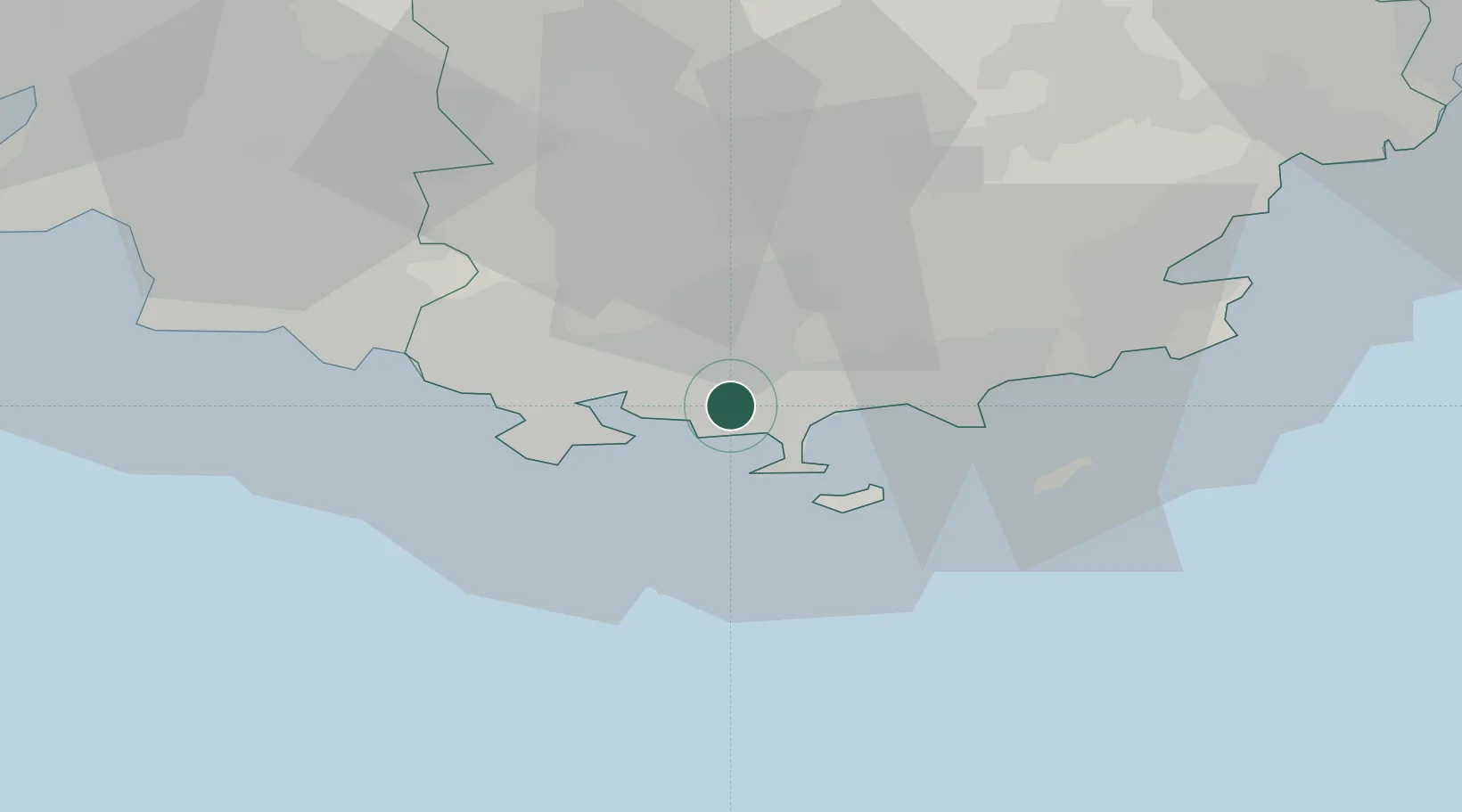
Nearby Logistics Neighbours

Cities
  1. 1La Crau4 km
  2. 2Hyères4 km
  3. 3Le Pradet5 km
  4. 4La Farlède6 km
  5. 5Solliès-Pont8 km
Nearest neighbours — logibook spatial index (haversine) over the source coordinates
Ports
  1. 1Toulon12 km
  2. 2Saint-Tropez49 km
  3. 3Marseille61 km
  4. 4Saint-Raphael66 km
  5. 5Cannes91 km
Nearest neighbours — logibook spatial index (haversine) over the source coordinates
Airports
  1. 1Toulon-Hyères Airport7 km
  2. 2Le Castellet Airport27 km
  3. 3La Môle Airport35 km
  4. 4Le Luc-Le Cannet Airfield40 km
  5. 5Marseille Provence Airport78 km
Nearest neighbours — logibook spatial index (haversine) over the source coordinates
Trade Zones
  1. 1ZFU Toulon10 km
  2. 2ZFU La Seyne-sur-Mer19 km
  3. 3ZFU Marseille 15e et 16e62 km
  4. 4ZFU Saint-Barthélémy, Le Canet, Delorme-Paternelle69 km
  5. 5ZFU LAriane121 km
Nearest neighbours — logibook spatial index (haversine) over the source coordinates
DatabookThe Record of Consolidated Knowledge
France beyond logistics?
Browse databook

All Sources

LocationsUN/LOCODE
UN/LOCODE — free
Portsthe NGA World Port Index
Public domain (US gov)
AirportsOurAirports
Public domain
Trade Zonesthe World Bank SEZ database
CC BY 4.0
Trade ZonesOpen Zone Map
CC BY
← France locations