UN/LOCODE hub · France
FREBT

Abrest

46.1000°, 3.4333°
2,503
Population
1
Transport functions

Transport Functions

Multimodal
UN/LOCODE

Hub Profile

Place type
Populated place
GeoNames
Region
Rhône-Alpes
GeoNames
Population
2,503
GeoNames
Time zone
Europe/Paris
GeoNames
Elevation
284 m
GeoNames

Location

Location of FREBT
Natural Earth 10m (public domain) · Rhône-Alpes · FREBT · 46.10, 3.43GoogleOSMYandex

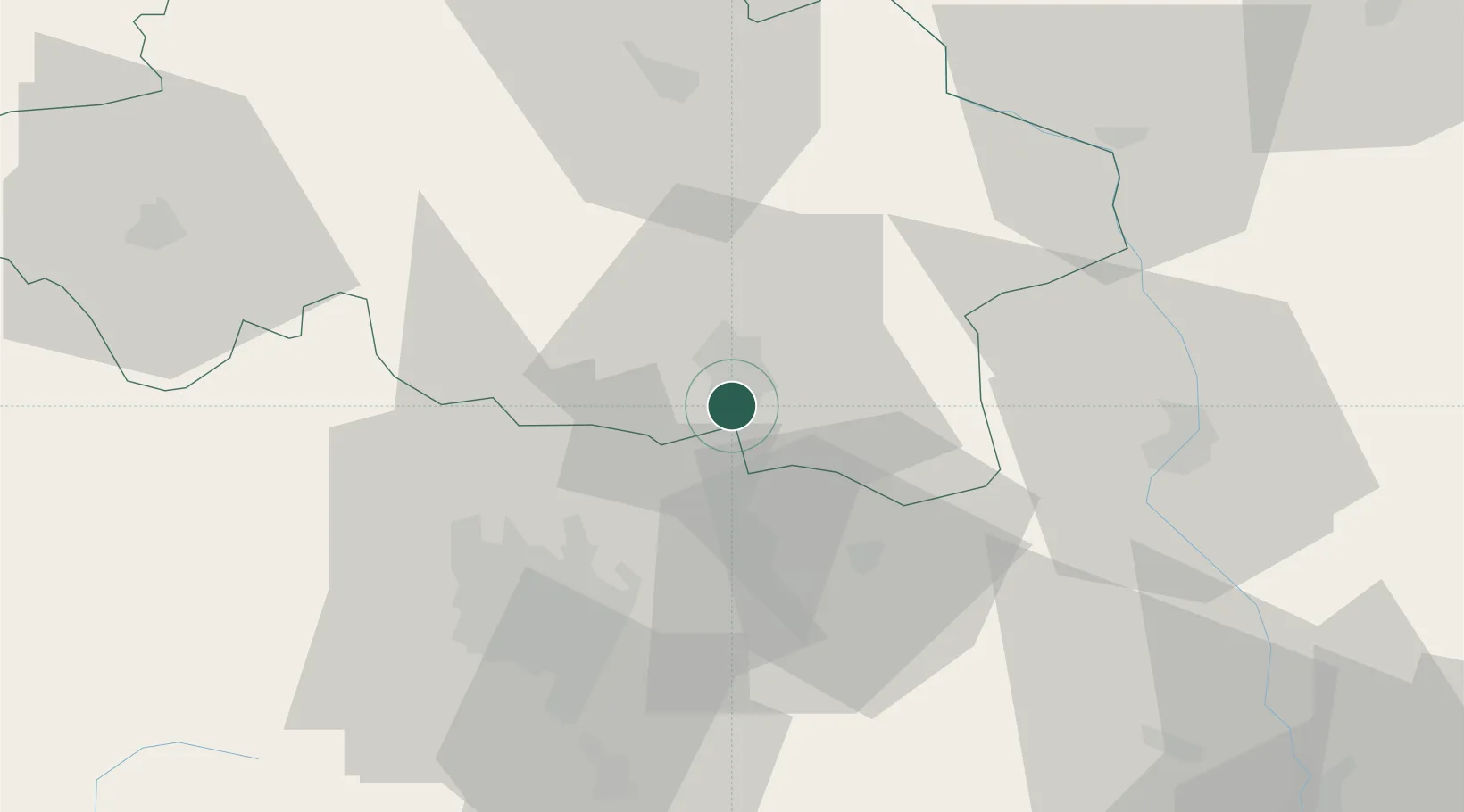
Nearby Logistics Neighbours

Cities
  1. 1Vichy4 km
  2. 2Creuzier-le-Neuf9 km
  3. 3Orcet16 km
  4. 4Gannat18 km
  5. 5Périgny19 km
Nearest neighbours — logibook spatial index (haversine) over the source coordinates
Ports
  1. 1Sete301 km
  2. 2Fos320 km
  3. 3Port Saint Louis Du Rhone321 km
  4. 4Port-de-Bouc324 km
  5. 5Ambes331 km
Nearest neighbours — logibook spatial index (haversine) over the source coordinates
Airports
  1. 1Vichy-Charmeil Airport8 km
  2. 2Clermont-Ferrand Auvergne airport40 km
  3. 3Roanne-Renaison Airport44 km
  4. 4Saint-Yan Airport57 km
  5. 5Montluçon-Guéret Airport84 km
Nearest neighbours — logibook spatial index (haversine) over the source coordinates
Trade Zones
  1. 1ZFU Clermont-Ferrand44 km
  2. 2ZFU Saint-Etienne101 km
  3. 3ZFU Lyon 9e112 km
  4. 4ZFU Rillieux-la-Pape114 km
  5. 5ZFU Vénissieux119 km
Nearest neighbours — logibook spatial index (haversine) over the source coordinates
DatabookThe Record of Consolidated Knowledge
France beyond logistics?
Browse databook

All Sources

LocationsUN/LOCODE
UN/LOCODE — free
LocationsGeoNames
CC BY 4.0
Portsthe NGA World Port Index
Public domain (US gov)
AirportsOurAirports
Public domain
Trade Zonesthe World Bank SEZ database
CC BY 4.0
Trade ZonesOpen Zone Map
CC BY
← France locations