UN/LOCODE hub · France
FRAVV

Ambleville

45.5500°, -0.2167°
221
Population
1
Transport functions

Transport Functions

Multimodal
UN/LOCODE

Hub Profile

Place type
Populated place
GeoNames
Region
Nouvelle-Aquitaine
GeoNames
Population
221
GeoNames
Time zone
Europe/Paris
GeoNames
Elevation
47 m
GeoNames

Location

Location of FRAVV
Natural Earth 10m (public domain) · Nouvelle-Aquitaine · FRAVV · 45.55, -0.22GoogleOSMYandex

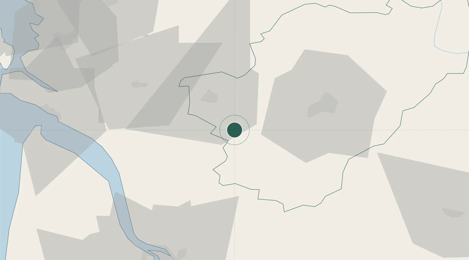
Nearby Logistics Neighbours

Cities
  1. 1Criteuil-la-Magdeleine2 km
  2. 2Lignières-Sonneville3 km
  3. 3Verrières4 km
  4. 4Bouteville9 km
  5. 5Mainxe10 km
Nearest neighbours — logibook spatial index (haversine) over the source coordinates
Ports
  1. 1Pauillac57 km
  2. 2Blaye58 km
  3. 3Ambes64 km
  4. 4Le Verdon65 km
  5. 5Tonnay Charente68 km
Nearest neighbours — logibook spatial index (haversine) over the source coordinates
Airports
  1. 1Cognac-Châteaubernard (BA 709) Air Base14 km
  2. 2Angoulême Brie-Champniers airport40 km
  3. 3Royan-Médis Airport60 km
  4. 4Rochefort-Saint-Agnant (BA 721) Airport70 km
  5. 5Niort - Marais Poitevin Airport86 km
Nearest neighbours — logibook spatial index (haversine) over the source coordinates
Trade Zones
  1. 1Port de Bordeaux75 km
  2. 2ZFU Hauts de Garonne85 km
  3. 3ZFU La Rochelle103 km
  4. 4ZFU Angers217 km
  5. 5ZFU Nantes et Saint-Herblain218 km
Nearest neighbours — logibook spatial index (haversine) over the source coordinates
DatabookThe Record of Consolidated Knowledge
France beyond logistics?
Browse databook

All Sources

LocationsUN/LOCODE
UN/LOCODE — free
LocationsGeoNames
CC BY 4.0
Portsthe NGA World Port Index
Public domain (US gov)
AirportsOurAirports
Public domain
Trade Zonesthe World Bank SEZ database
CC BY 4.0
Trade ZonesOpen Zone Map
CC BY
← France locations