UN/LOCODE hub · Spain
ES4SS

Santurtz

43.3167°, -3.0167°
2
Transport functions

Transport Functions

Port
Road
UN/LOCODE

Hub Profile

Region
BI
GeoNames

Location

Location of ES4SS
Natural Earth 10m (public domain) · BI · ES4SS · 43.32, -3.02GoogleOSMYandex

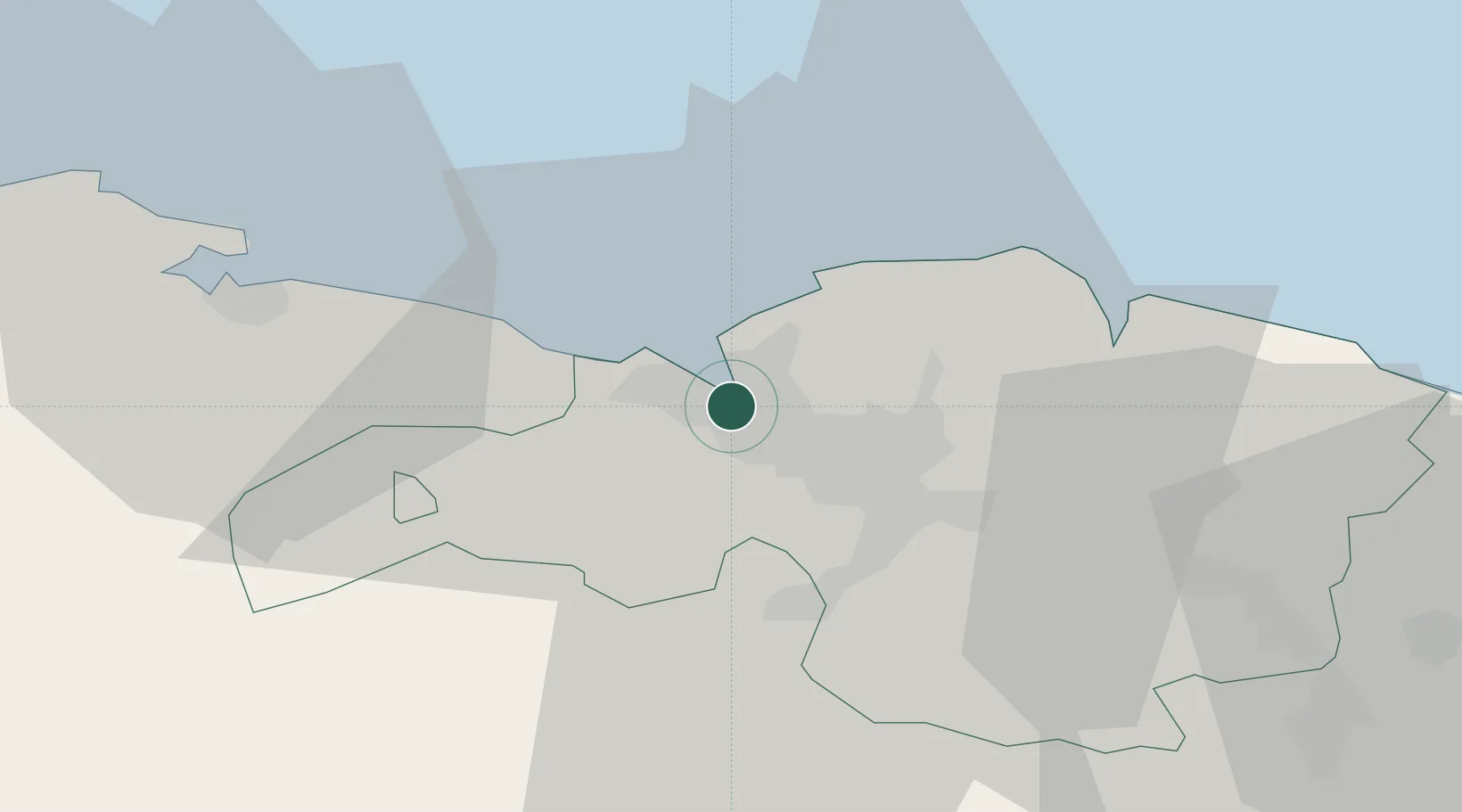
Nearby Logistics Neighbours

Cities
  1. 1Bilbao1 km
  2. 2Lejona1 km
  3. 3Urioste1 km
  4. 4Algorta4 km
  5. 5Ortuella4 km
Nearest neighbours — logibook spatial index (haversine) over the source coordinates
Ports
  1. 1Puerto De Bilbao5 km
  2. 2Bermeo27 km
  3. 3Santander64 km
  4. 4Puerto De Pasajes88 km
  5. 5Bayonne127 km
Nearest neighbours — logibook spatial index (haversine) over the source coordinates
Airports
  1. 1Bilbao Airport9 km
  2. 2Vitoria Airport54 km
  3. 3Seve Ballesteros-Santander Airport66 km
  4. 4San Sebastián Airport99 km
  5. 5Logroño-Agoncillo Airport111 km
Nearest neighbours — logibook spatial index (haversine) over the source coordinates
Trade Zones
  1. 1Depósito Franco de Bilbao3 km
  2. 2Zona Franca de Santander66 km
  3. 3Depósito Franco de Pasajes (Guipúzcoa)89 km
  4. 4Depósito Franco de Villafría (Burgos)120 km
  5. 5Depósito Franco de Gijón218 km
Nearest neighbours — logibook spatial index (haversine) over the source coordinates
DatabookThe Record of Consolidated Knowledge
Spain beyond logistics?
Browse databook

All Sources

LocationsUN/LOCODE
UN/LOCODE — free
Portsthe NGA World Port Index
Public domain (US gov)
AirportsOurAirports
Public domain
Trade Zonesthe World Bank SEZ database
CC BY 4.0
Trade ZonesOpen Zone Map
CC BY
← Spain locations