UN/LOCODE hub · Estonia
EERPI

Räpina

58.1333°, 27.5333°
1
Transport functions

Transport Functions

Port
UN/LOCODE

Hub Profile

Region
64
GeoNames

Location

Location of EERPI
Natural Earth 10m (public domain) · 64 · EERPI · 58.13, 27.53GoogleOSMYandex

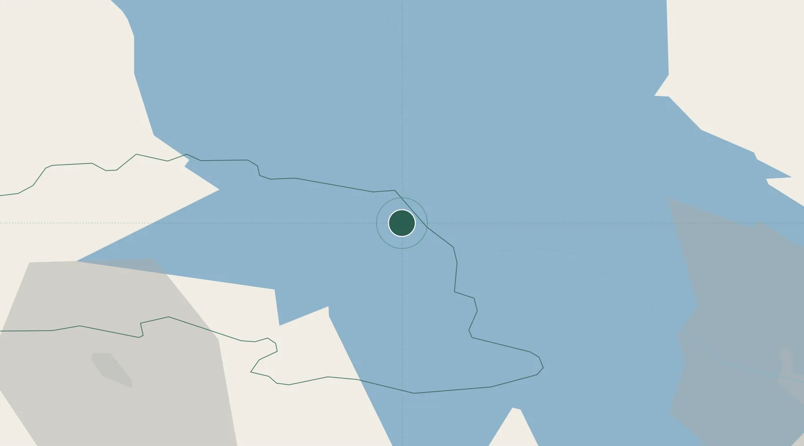
Nearby Logistics Neighbours

Cities
  1. 1Saarepera4 km
  2. 2Võõpsu6 km
  3. 3Võõpsu Külasadam8 km
  4. 4Mehikoorma Sadam12 km
  5. 5Värska Sadam21 km
Nearest neighbours — logibook spatial index (haversine) over the source coordinates
Ports
  1. 1Sillamae144 km
  2. 2Kunda165 km
  3. 3Ust Luga176 km
  4. 4Parnu181 km
  5. 5Loksa193 km
Nearest neighbours — logibook spatial index (haversine) over the source coordinates
Airports
  1. 1Tartu Airport53 km
  2. 2Princess Olga Pskov International Airport64 km
  3. 3Smuravyovo Air Base81 km
  4. 4Ostrov Naval Air Base107 km
  5. 5Pärnu Airport182 km
Nearest neighbours — logibook spatial index (haversine) over the source coordinates
Trade Zones
  1. 1Moglino Special Economic Zone - Industrial54 km
  2. 2Port of Sillamäe144 km
  3. 3Muuga Free Zone195 km
  4. 4Latgale SEZ205 km
  5. 5Rēzekne SEZ205 km
Nearest neighbours — logibook spatial index (haversine) over the source coordinates
DatabookThe Record of Consolidated Knowledge
Estonia beyond logistics?
Browse databook

All Sources

LocationsUN/LOCODE
UN/LOCODE — free
Portsthe NGA World Port Index
Public domain (US gov)
AirportsOurAirports
Public domain
Trade Zonesthe World Bank SEZ database
CC BY 4.0
Trade ZonesOpen Zone Map
CC BY
← Estonia locations