UN/LOCODE hub · Estonia
EEMRL

Merelaiu

58.3000°, 24.0167°
1
Transport functions

Transport Functions

Port
UN/LOCODE

Hub Profile

Region
68
GeoNames

Location

Location of EEMRL
Natural Earth 10m (public domain) · 68 · EEMRL · 58.30, 24.02GoogleOSMYandex

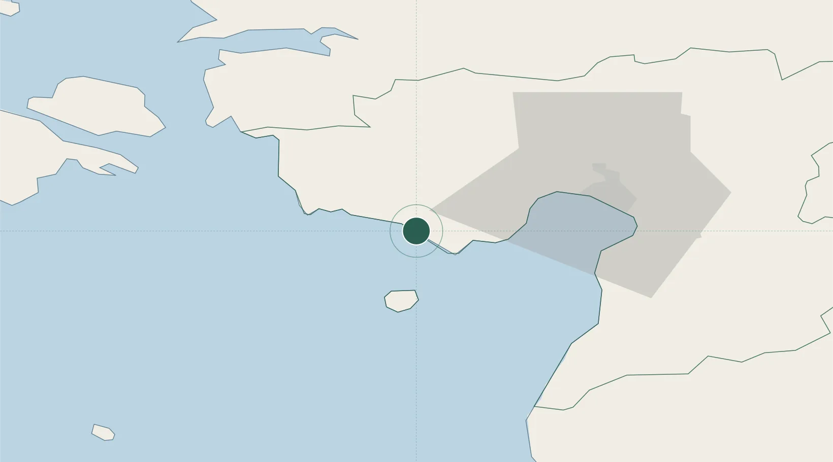
Nearby Logistics Neighbours

Cities
  1. 1Võidu2 km
  2. 2Värati3 km
  3. 3Kastna7 km
  4. 4Peerni9 km
  5. 5Lao9 km
Nearest neighbours — logibook spatial index (haversine) over the source coordinates
Ports
  1. 1Parnu29 km
  2. 2Virtsu43 km
  3. 3Salacgriva70 km
  4. 4Rohukula76 km
  5. 5Heltermaa84 km
Nearest neighbours — logibook spatial index (haversine) over the source coordinates
Airports
  1. 1Pärnu Airport30 km
  2. 2Ruhnu Airfield72 km
  3. 3Kuressaare Airport89 km
  4. 4Kärdla Airport103 km
  5. 5Ämari Air Base107 km
Nearest neighbours — logibook spatial index (haversine) over the source coordinates
Trade Zones
  1. 1Paldiski Free Zone115 km
  2. 2Muuga Free Zone125 km
  3. 3Free Port of Riga149 km
  4. 4Free port of Ventspils178 km
  5. 5Freeport of Hanko182 km
Nearest neighbours — logibook spatial index (haversine) over the source coordinates
DatabookThe Record of Consolidated Knowledge
Estonia beyond logistics?
Browse databook

All Sources

LocationsUN/LOCODE
UN/LOCODE — free
Portsthe NGA World Port Index
Public domain (US gov)
AirportsOurAirports
Public domain
Trade Zonesthe World Bank SEZ database
CC BY 4.0
Trade ZonesOpen Zone Map
CC BY
← Estonia locations