UN/LOCODE hub · Chile
CLLLG

Los Lagos

-39.8500°, -72.8333°
2
Transport functions

Transport Functions

Rail
Road
UN/LOCODE

Hub Profile

Place type
Populated place
GeoNames
Region
Los Ríos Region
GeoNames
Time zone
America/Santiago
GeoNames
Elevation
34 m
GeoNames

Location

Location of CLLLG
Natural Earth 10m (public domain) · Los Ríos Region · CLLLG · -39.85, -72.83GoogleOSMYandex

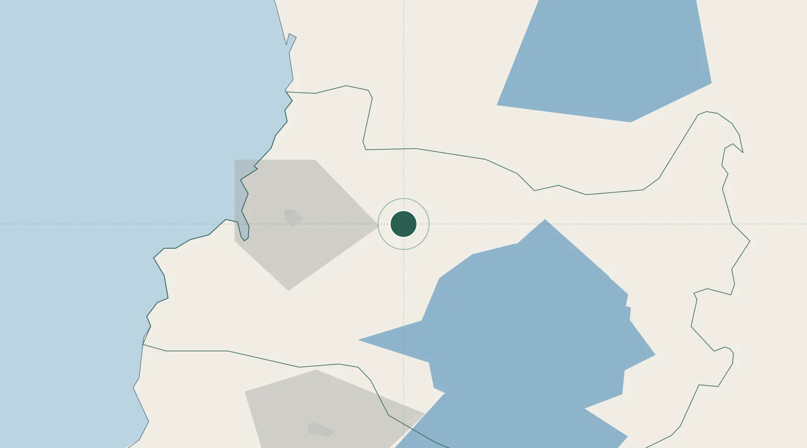
Nearby Logistics Neighbours

Cities
  1. 1Máfil24 km
  2. 2Paillaco25 km
  3. 3Valdivia33 km
  4. 4Lanco45 km
  5. 5Niebla47 km
Nearest neighbours — logibook spatial index (haversine) over the source coordinates
Ports
  1. 1Bahia De Valdivia36 km
  2. 2Puerto De Corral51 km
  3. 3Puerto Montt182 km
  4. 4Puerto Quemchi262 km
  5. 5Puerto Castro303 km
Nearest neighbours — logibook spatial index (haversine) over the source coordinates
Airports
  1. 1Pichoy Airport31 km
  2. 2Las Marías Airport35 km
  3. 3Cañal Bajo Carlos Hott Siebert Airport87 km
  4. 4Pucón Airport100 km
  5. 5La Araucanía International Airport104 km
Nearest neighbours — logibook spatial index (haversine) over the source coordinates
Trade Zones
  1. 1Zona Franca Zapala (Zapala Free Trade Zone)258 km
  2. 2Comodoro Free Trade Zone797 km
  3. 3Comodoro Free Trade Zone Zona Franca Chubut797 km
  4. 4Zona Franca Mendoza Free Trade Zone830 km
  5. 5La Zona Franca Santa Cruz (ZFSC) - Caleta Olivia853 km
Nearest neighbours — logibook spatial index (haversine) over the source coordinates
DatabookThe Record of Consolidated Knowledge
Chile beyond logistics?
Browse databook

All Sources

LocationsUN/LOCODE
UN/LOCODE — free
Portsthe NGA World Port Index
Public domain (US gov)
AirportsOurAirports
Public domain
Trade Zonesthe World Bank SEZ database
CC BY 4.0
Trade ZonesOpen Zone Map
CC BY
← Chile locations