UN/LOCODE hub · United States
USWJU

Wood River Junction

41.4333°, -71.6833°
2
Transport functions

Transport Functions

Rail
Road
UN/LOCODE

Hub Profile

Place type
Populated place
GeoNames
Region
Rhode Island
GeoNames
Time zone
America/New_York
GeoNames
Elevation
16 m
GeoNames

Location

Location of USWJU
Natural Earth 10m (public domain) · Rhode Island · USWJU · 41.43, -71.68GoogleOSMYandex

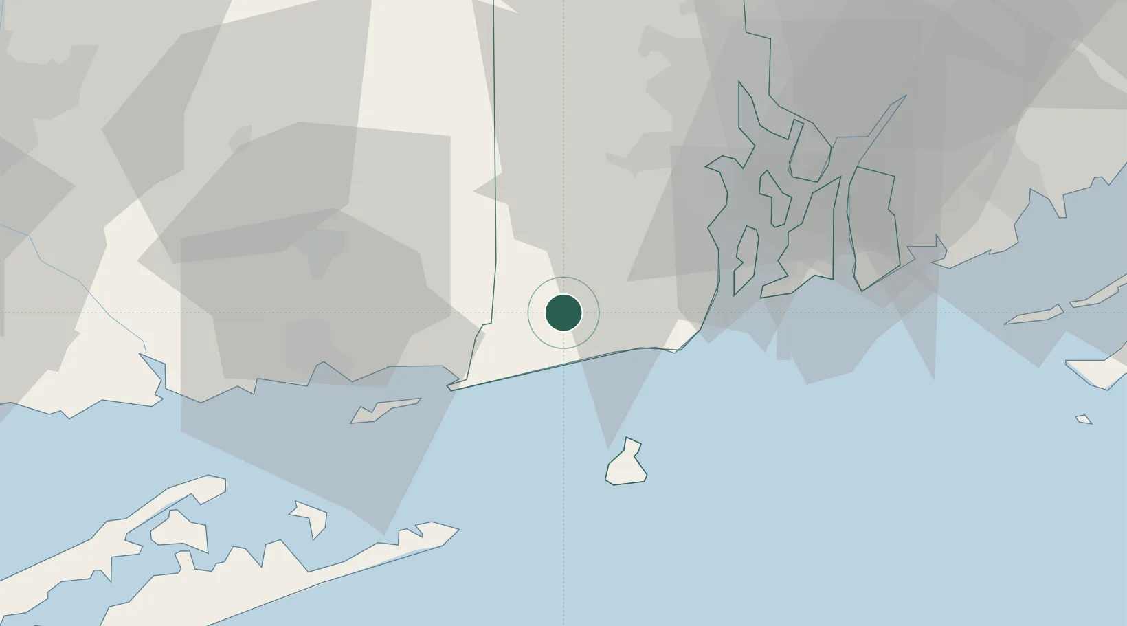
Nearby Logistics Neighbours

Cities
  1. 1Carolina2 km
  2. 2Ashaway9 km
  3. 3West Kingston12 km
  4. 4South Kingstown14 km
  5. 5Slocum17 km
Nearest neighbours — logibook spatial index (haversine) over the source coordinates
Ports
  1. 1Stonington21 km
  2. 2Mystic25 km
  3. 3Noank28 km
  4. 4Quonset Point29 km
  5. 5Newport30 km
Nearest neighbours — logibook spatial index (haversine) over the source coordinates
Airports
  1. 1Westerly State Airport14 km
  2. 2Quonset State Airport29 km
  3. 3Block Island State Airport31 km
  4. 4Groton New London Airport32 km
  5. 5Newport State Airport35 km
Nearest neighbours — logibook spatial index (haversine) over the source coordinates
Trade Zones
  1. 1FTZ No. 208 New London36 km
  2. 2FTZ No. 105 Providence and North Kingstown47 km
  3. 3FTZ No. 028 New Bedford63 km
  4. 4FTZ No. 071 Windsor Locks96 km
  5. 5FTZ No. 162 New Haven105 km
Nearest neighbours — logibook spatial index (haversine) over the source coordinates
DatabookThe Record of Consolidated Knowledge
United States beyond logistics?
Browse databook

All Sources

LocationsUN/LOCODE
UN/LOCODE — free
Portsthe NGA World Port Index
Public domain (US gov)
AirportsOurAirports
Public domain
Trade Zonesthe World Bank SEZ database
CC BY 4.0
Trade ZonesOpen Zone Map
CC BY
← United States locations