UN/LOCODE hub · Greece
GRYAL

Yaltra

38.8500°, 22.9833°
1
Transport functions

Transport Functions

Port
UN/LOCODE

Hub Profile

Region
04
GeoNames

Location

Location of GRYAL
Natural Earth 10m (public domain) · 04 · GRYAL · 38.85, 22.98GoogleOSMYandex

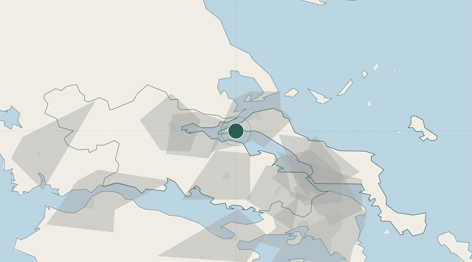
Nearby Logistics Neighbours

Cities
  1. 1Aidipsou4 km
  2. 2Edipsos5 km
  3. 3Agios Georgios9 km
  4. 4Agiokampos Oreon10 km
  5. 5Glyfa Fthiotidas11 km
Nearest neighbours — logibook spatial index (haversine) over the source coordinates
Ports
  1. 1Achladi16 km
  2. 2Tsingeli37 km
  3. 3Kymassi42 km
  4. 4Volos58 km
  5. 5Itea68 km
Nearest neighbours — logibook spatial index (haversine) over the source coordinates
Airports
  1. 1Nea Anchialos National Airport44 km
  2. 2Skiathos Island National Airport58 km
  3. 3Tanagra Air Base76 km
  4. 4Elefsis Air Base101 km
  5. 5Skiros Airport131 km
Nearest neighbours — logibook spatial index (haversine) over the source coordinates
Trade Zones
  1. 1Free Zone of Piraeus115 km
  2. 2Free Zone of Platigiali (Astakos Etoloakarnanias)169 km
  3. 3Free Zone of Thessaloniki199 km
  4. 4TIDZ Gevgelija264 km
  5. 5Korçë Freezone273 km
Nearest neighbours — logibook spatial index (haversine) over the source coordinates
DatabookThe Record of Consolidated Knowledge
Greece beyond logistics?
Browse databook

All Sources

LocationsUN/LOCODE
UN/LOCODE — free
Portsthe NGA World Port Index
Public domain (US gov)
AirportsOurAirports
Public domain
Trade Zonesthe World Bank SEZ database
CC BY 4.0
Trade ZonesOpen Zone Map
CC BY
← Greece locations