UN/LOCODE hub · Greece
GRKGS

Kos

36.8667°, 27.2500°
19,244
Population
2
Transport functions

Transport Functions

Port
Airport
Kos is also a profiled seaport →
UN/LOCODE

Hub Profile

Place type
District seat
GeoNames
Region
South Aegean
GeoNames
Population
19,244
GeoNames
Time zone
Europe/Athens
GeoNames
Elevation
10 m
GeoNames

Location

Location of GRKGS
Natural Earth 10m (public domain) · South Aegean · GRKGS · 36.87, 27.25GoogleOSMYandex

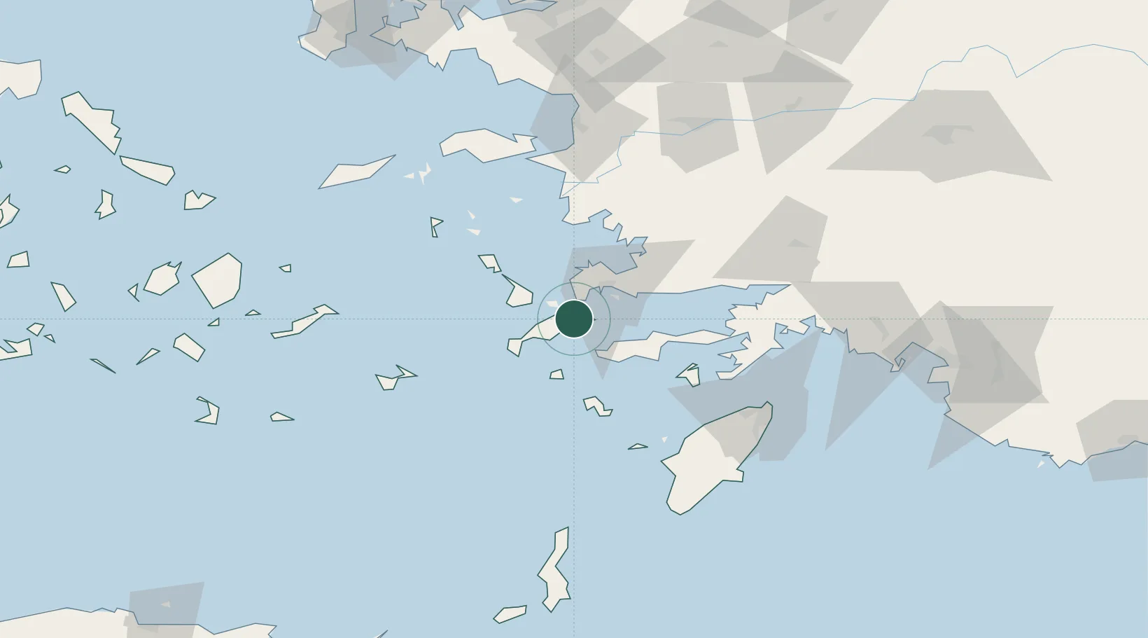
Nearby Logistics Neighbours

Cities
  1. 1Phserimos Dodekanisou13 km
  2. 2Kardamaina Kos13 km
  3. 3Mastichari Kos16 km
  4. 4Bodrum24 km
  5. 5Kálymnos26 km
Nearest neighbours — logibook spatial index (haversine) over the source coordinates
Ports
  1. 1Bodrum25 km
  2. 2Kalimnos26 km
  3. 3Lakki46 km
  4. 4Gulluk54 km
  5. 5Marmaris92 km
Nearest neighbours — logibook spatial index (haversine) over the source coordinates
Airports
  1. 1Kos International Airport "Ippokratis"16 km
  2. 2Kalymnos Airport30 km
  3. 3Leros Airport53 km
  4. 4Milas Bodrum International Airport56 km
  5. 5Astypalaia Airport84 km
Nearest neighbours — logibook spatial index (haversine) over the source coordinates
Trade Zones
  1. 1Tire Organized Industrial Zone145 km
  2. 2Aegean Free Zone164 km
  3. 3Izmir Ataturk Organized Industrial Zone182 km
  4. 4Manisa Organized Industrial Zone195 km
  5. 5Izmir Free Zone197 km
Nearest neighbours — logibook spatial index (haversine) over the source coordinates
DatabookThe Record of Consolidated Knowledge
Greece beyond logistics?
Browse databook

All Sources

LocationsUN/LOCODE
UN/LOCODE — free
LocationsGeoNames
CC BY 4.0
Portsthe NGA World Port Index
Public domain (US gov)
AirportsOurAirports
Public domain
Trade Zonesthe World Bank SEZ database
CC BY 4.0
Trade ZonesOpen Zone Map
CC BY
← Greece locations