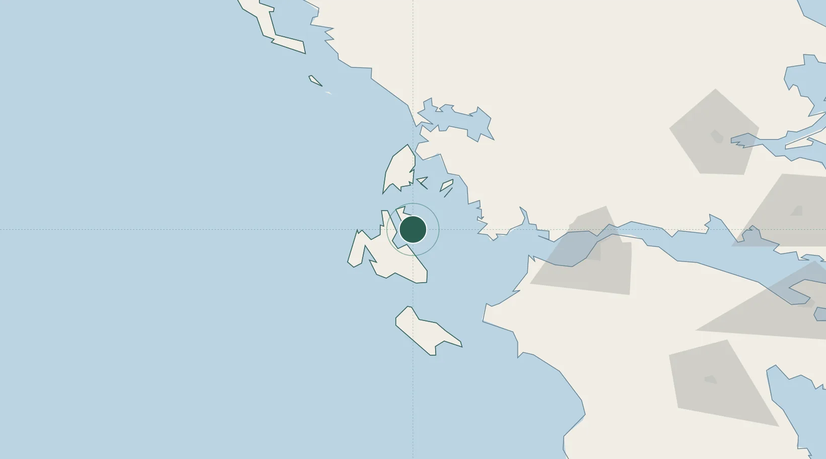
UN/LOCODE hub · Greece
GRITH

Ithaki (Ithaca)

38.3667°, 20.7167°
1
Transport functions

Transport Functions

Port
UN/LOCODE

Location

Location of GRITH
Natural Earth 10m (public domain) · Ionioi Nisoi · GRITH · 38.37, 20.72GoogleOSMYandex

Nearby Logistics Neighbours

Cities
  1. 1Pissaetos Ithakis3 km
  2. 2Frikes Ithakis12 km
  3. 3Agia Efimia13 km
  4. 4Sámi14 km
  5. 5Fiskárdo16 km
Nearest neighbours — logibook spatial index (haversine) over the source coordinates
Ports
  1. 1Argostolion27 km
  2. 2Astakos36 km
  3. 3Mesolongion61 km
  4. 4Preveza65 km
  5. 5Patrai90 km
Nearest neighbours — logibook spatial index (haversine) over the source coordinates
Airports
  1. 1Kefallinia Airport33 km
  2. 2Aktion National Airport62 km
  3. 3Patras Araxos Agamemnon Airport66 km
  4. 4Zakynthos International Airport Dionysios Solomos70 km
  5. 5Andravida Air Base71 km
Nearest neighbours — logibook spatial index (haversine) over the source coordinates
Trade Zones
  1. 1Free Zone of Platigiali (Astakos Etoloakarnanias)36 km
  2. 2Gjirokastër Freezone195 km
  3. 3Përmet Freezone211 km
  4. 4Korçë Freezone253 km
  5. 5Free Zone of Piraeus258 km
Nearest neighbours — logibook spatial index (haversine) over the source coordinates
DatabookThe Record of Consolidated Knowledge
Greece beyond logistics?
Browse databook

All Sources

LocationsUN/LOCODE
UN/LOCODE — free
Portsthe NGA World Port Index
Public domain (US gov)
AirportsOurAirports
Public domain
Trade Zonesthe World Bank SEZ database
CC BY 4.0
Trade ZonesOpen Zone Map
CC BY
← Greece locations