UN/LOCODE hub · Spain
ESZDE

Boqueixon

42.8167°, -8.4167°
1
Transport functions

Transport Functions

Multimodal
UN/LOCODE

Hub Profile

Region
C
GeoNames

Location

Location of ESZDE
Natural Earth 10m (public domain) · C · ESZDE · 42.82, -8.42GoogleOSMYandex

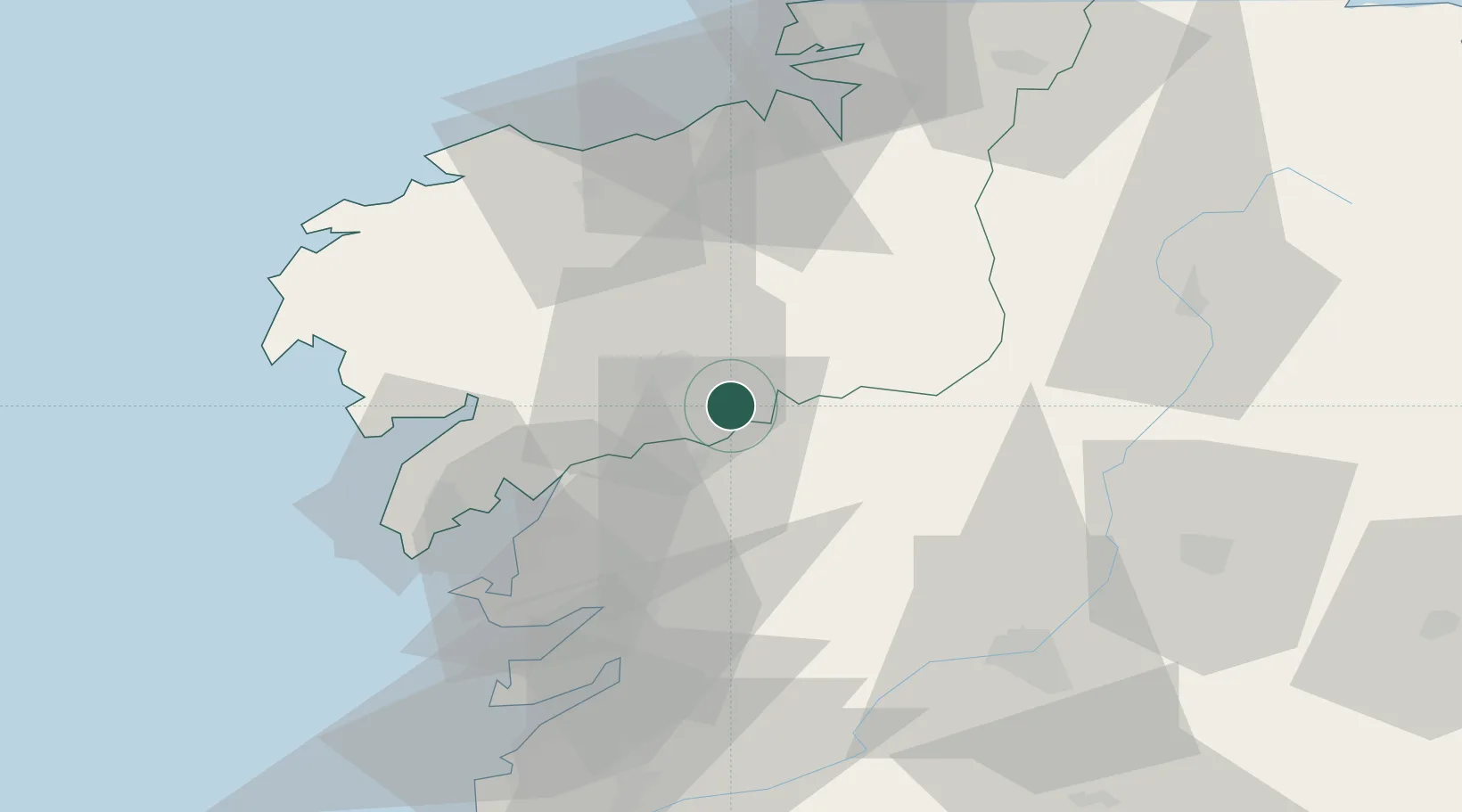
Nearby Logistics Neighbours

Cities
  1. 1Vedra6 km
  2. 2Teo10 km
  3. 3Bandeira13 km
  4. 4La Estrada16 km
  5. 5Oroso19 km
Nearest neighbours — logibook spatial index (haversine) over the source coordinates
Ports
  1. 1Villagarcia De Arosa37 km
  2. 2Marin52 km
  3. 3La Coruna61 km
  4. 4Vigo69 km
  5. 5Ferrol76 km
Nearest neighbours — logibook spatial index (haversine) over the source coordinates
Airports
  1. 1Santiago-Rosalía de Castro Airport9 km
  2. 2A Coruña Airport54 km
  3. 3Vigo Airport67 km
  4. 4Braga Municipal Aerodrome137 km
  5. 5Vilar de Luz Airfield171 km
Nearest neighbours — logibook spatial index (haversine) over the source coordinates
Trade Zones
  1. 1Depósito Franco de La Coruña60 km
  2. 2Zona Franca de Vigo71 km
  3. 3Zona Livre Tecnológica Masotinhos184 km
  4. 4VGP Park Santa Maria da Feira210 km
  5. 5Depósito Franco de Gijón236 km
Nearest neighbours — logibook spatial index (haversine) over the source coordinates
DatabookThe Record of Consolidated Knowledge
Spain beyond logistics?
Browse databook

All Sources

LocationsUN/LOCODE
UN/LOCODE — free
Portsthe NGA World Port Index
Public domain (US gov)
AirportsOurAirports
Public domain
Trade Zonesthe World Bank SEZ database
CC BY 4.0
Trade ZonesOpen Zone Map
CC BY
← Spain locations