UN/LOCODE hub · Estonia
EELIU

Liu

58.2833°, 24.2667°
118
Population
1
Transport functions

Transport Functions

Port
UN/LOCODE

Hub Profile

Place type
Populated place
GeoNames
Region
Pärnumaa
GeoNames
Population
118
GeoNames
Time zone
Europe/Tallinn
GeoNames

Location

Location of EELIU
Natural Earth 10m (public domain) · Pärnumaa · EELIU · 58.28, 24.27GoogleOSMYandex

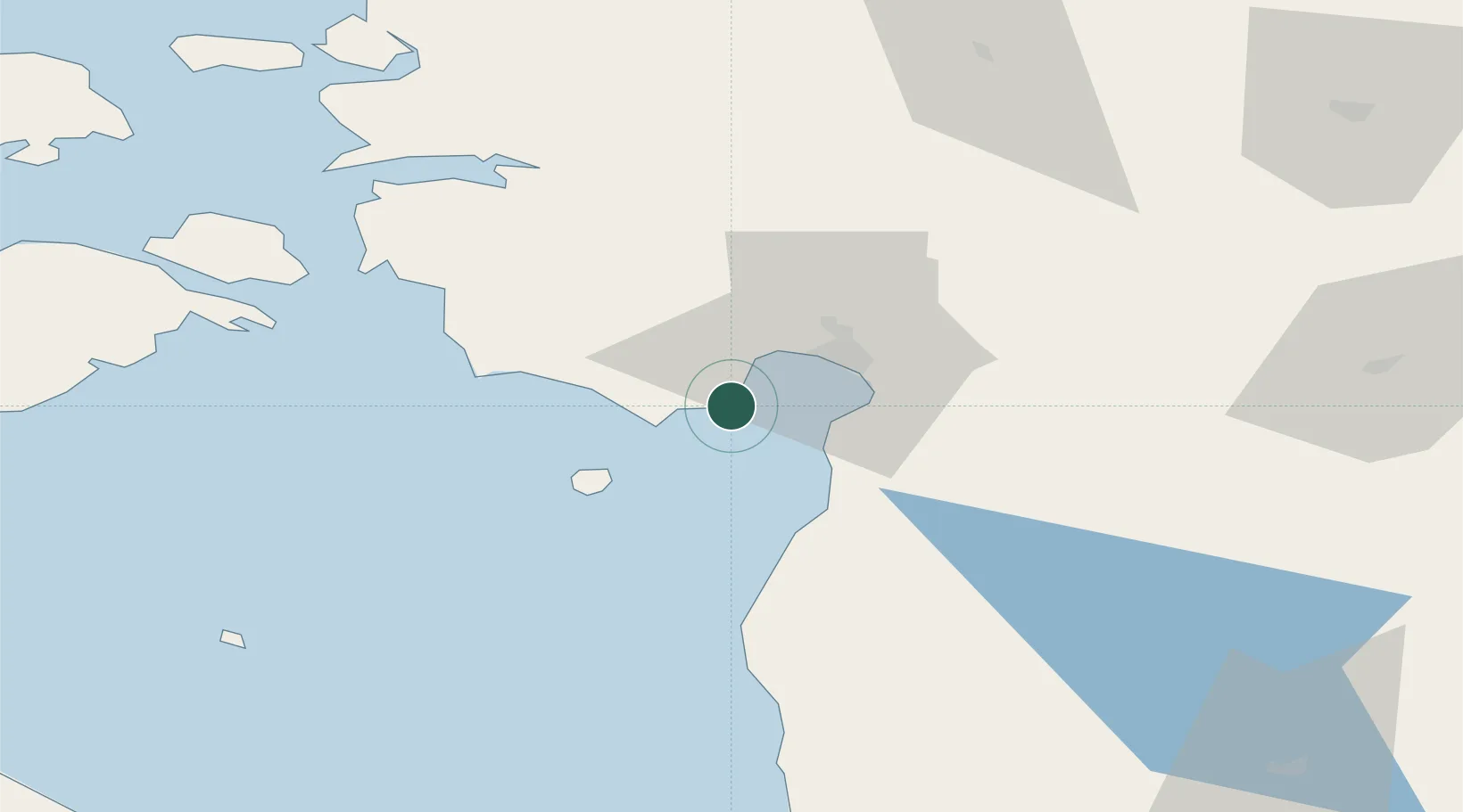
Nearby Logistics Neighbours

Cities
  1. 1Lindi6 km
  2. 2Kavaru6 km
  3. 3Peerni9 km
  4. 4Lao10 km
  5. 5Munalaiu10 km
Nearest neighbours — logibook spatial index (haversine) over the source coordinates
Ports
  1. 1Parnu17 km
  2. 2Virtsu55 km
  3. 3Salacgriva65 km
  4. 4Rohukula85 km
  5. 5Heltermaa96 km
Nearest neighbours — logibook spatial index (haversine) over the source coordinates
Airports
  1. 1Pärnu Airport19 km
  2. 2Ruhnu Airfield81 km
  3. 3Kuressaare Airport103 km
  4. 4Ämari Air Base109 km
  5. 5Kärdla Airport114 km
Nearest neighbours — logibook spatial index (haversine) over the source coordinates
Trade Zones
  1. 1Paldiski Free Zone117 km
  2. 2Muuga Free Zone121 km
  3. 3Free Port of Riga148 km
  4. 4Freeport of Hanko189 km
  5. 5Free port of Ventspils190 km
Nearest neighbours — logibook spatial index (haversine) over the source coordinates
DatabookThe Record of Consolidated Knowledge
Estonia beyond logistics?
Browse databook

All Sources

LocationsUN/LOCODE
UN/LOCODE — free
LocationsGeoNames
CC BY 4.0
Portsthe NGA World Port Index
Public domain (US gov)
AirportsOurAirports
Public domain
Trade Zonesthe World Bank SEZ database
CC BY 4.0
Trade ZonesOpen Zone Map
CC BY
← Estonia locations