UN/LOCODE hub · China
CNCGD

Changde

29.0001°, 111.6968°
1,457,419
Population
1
Transport functions

Transport Functions

Multimodal
UN/LOCODE

Hub Profile

Place type
District seat
GeoNames
Region
Hunan
GeoNames
Population
1,457,419
GeoNames
Time zone
Asia/Shanghai
GeoNames
Elevation
38 m
GeoNames
Logistics facilities
4
UN/LOCODE

Location

Location of CNCGD
Natural Earth 10m (public domain) · Hunan · CNCGD · 29.00, 111.70GoogleOSMYandex

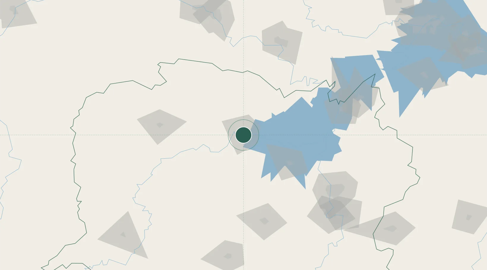
Nearby Logistics Neighbours

Cities
  1. 1Zhangjiajie123 km
  2. 2Shaoshan145 km
  3. 3Chenglingji Pt149 km
  4. 4Yueyang150 km
  5. 5Changsha154 km
Nearest neighbours — logibook spatial index (haversine) over the source coordinates
Ports
  1. 1Hankow305 km
  2. 2Guangzhou672 km
  3. 3Huangpu680 km
  4. 4Huangpuxingang686 km
  5. 5Huizhou753 km
Nearest neighbours — logibook spatial index (haversine) over the source coordinates
Airports
  1. 1Changde Taohuayuan Airport11 km
  2. 2Zhangjiajie Hehua International Airport122 km
  3. 3Ningxiang Airport143 km
  4. 4Yueyang Sanhe Airport158 km
  5. 5Changsha Datuopu Airport / Changsha Air Base161 km
Nearest neighbours — logibook spatial index (haversine) over the source coordinates
Trade Zones
  1. 1Hanshou High-tech Industrial Park35 km
  2. 2Anxiang Industrial Concentration Zone63 km
  3. 3Taojiang Economic Development Zone67 km
  4. 4Yuanjiang High-tech Industrial Park68 km
  5. 5Cili Industrial Concentration Zone71 km
Nearest neighbours — logibook spatial index (haversine) over the source coordinates
DatabookThe Record of Consolidated Knowledge
China beyond logistics?
Browse databook

All Sources

LocationsUN/LOCODE
UN/LOCODE — free
LocationsGeoNames
CC BY 4.0
Portsthe NGA World Port Index
Public domain (US gov)
AirportsOurAirports
Public domain
Trade Zonesthe World Bank SEZ database
CC BY 4.0
Trade ZonesOpen Zone Map
CC BY
← China locations