UN/LOCODE hub · Chile
CLQIL

Quilpué

-33.0333°, -71.4333°
130,263
Population
2
Transport functions

Transport Functions

Rail
Road
UN/LOCODE

Hub Profile

Place type
Provincial seat
GeoNames
Region
Valparaíso
GeoNames
Population
130,263
GeoNames
Time zone
America/Santiago
GeoNames
Elevation
113 m
GeoNames

Location

Location of CLQIL
Natural Earth 10m (public domain) · Valparaíso · CLQIL · -33.03, -71.43GoogleOSMYandex

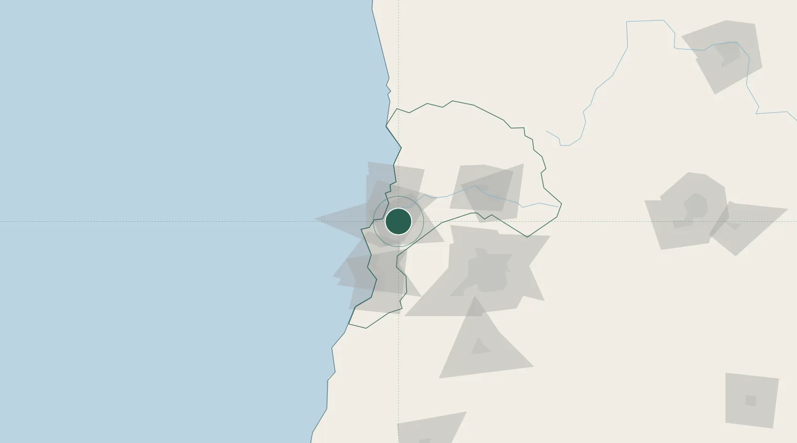
Nearby Logistics Neighbours

Cities
  1. 1Villa Alemana6 km
  2. 2Viña del Mar12 km
  3. 3Limache15 km
  4. 4Valparaiso18 km
  5. 5Quillota23 km
Nearest neighbours — logibook spatial index (haversine) over the source coordinates
Ports
  1. 1Bahia De Valparaiso17 km
  2. 2Bahia Quintero (Ventanas)31 km
  3. 3Puerto San Antonio64 km
  4. 4Bahia Herradura Guayacan341 km
  5. 5Coquimbo343 km
Nearest neighbours — logibook spatial index (haversine) over the source coordinates
Airports
  1. 1Viña del Mar Airport10 km
  2. 2Comodoro Arturo Merino Benítez International Airport72 km
  3. 3La Independencia Airport141 km
  4. 4Governor Francisco Gabrielli International Airport247 km
  5. 5Panguilemo Airport261 km
Nearest neighbours — logibook spatial index (haversine) over the source coordinates
Trade Zones
  1. 1Zona Franca Mendoza Free Trade Zone229 km
  2. 2Zona Franca de San Luis587 km
  3. 3Justo Daract Free Trade Zone587 km
  4. 4Zona Franca Zapala (Zapala Free Trade Zone)660 km
  5. 5Córdoba Free Trade Zone710 km
Nearest neighbours — logibook spatial index (haversine) over the source coordinates
DatabookThe Record of Consolidated Knowledge
Chile beyond logistics?
Browse databook

All Sources

LocationsUN/LOCODE
UN/LOCODE — free
LocationsGeoNames
CC BY 4.0
Portsthe NGA World Port Index
Public domain (US gov)
AirportsOurAirports
Public domain
Trade Zonesthe World Bank SEZ database
CC BY 4.0
Trade ZonesOpen Zone Map
CC BY
← Chile locations