UN/LOCODE hub · Chile
CLEDE

Puerto Edén

-49.1500°, -74.4500°
1
Transport functions

Transport Functions

Port
UN/LOCODE

Hub Profile

Region
MA
GeoNames

Location

Location of CLEDE
Natural Earth 10m (public domain) · MA · CLEDE · -49.15, -74.45GoogleOSMYandex

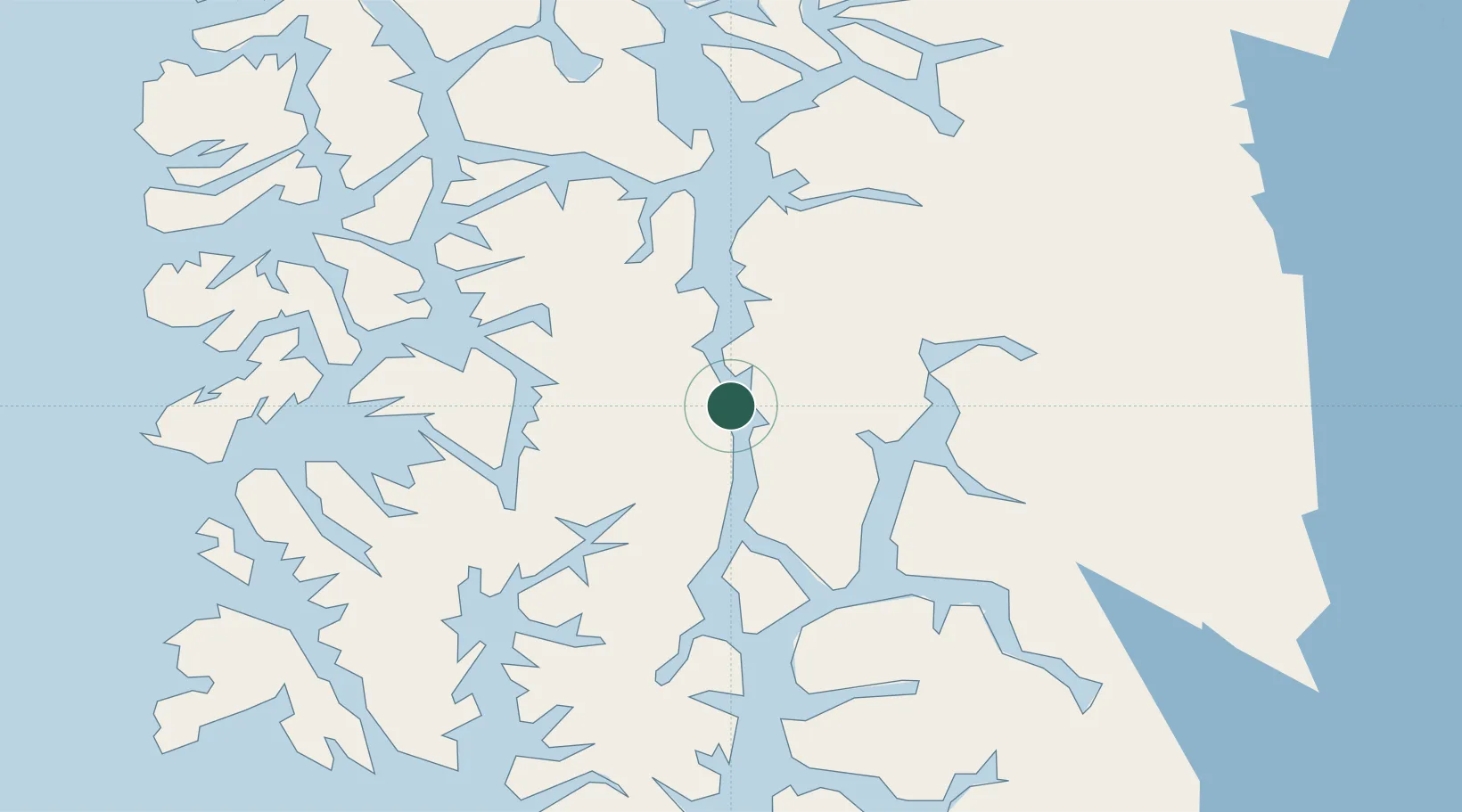
Nearby Logistics Neighbours

Cities
  1. 1Paso Lago O'Higgins/O'Higgins134 km
  2. 2O'Higgins158 km
  3. 3Tortel160 km
  4. 4Puerto Natales317 km
  5. 5Isla Guarello395 km
Nearest neighbours — logibook spatial index (haversine) over the source coordinates
Ports
  1. 1Puerto Natales315 km
  2. 2Puerto Chacabuco427 km
  3. 3Puerto Santa Cruz438 km
  4. 4Puerto Gallegos476 km
  5. 5Puerto Sara489 km
Nearest neighbours — logibook spatial index (haversine) over the source coordinates
Airports
  1. 1El Calafate - Commander Armando Tola International Airport213 km
  2. 2Cochrane Airport253 km
  3. 3Lieutenant Julio Gallardo Airport312 km
  4. 428 de Noviembre Airport315 km
  5. 5Gobernador Gregores Airport317 km
Nearest neighbours — logibook spatial index (haversine) over the source coordinates
Trade Zones
  1. 1La Zona Franca Santa Cruz (ZFSC) - Río Gallegos465 km
  2. 2Punta Arenas Free Trade Zone508 km
  3. 3La Zona Franca Santa Cruz (ZFSC) - Caleta Olivia597 km
  4. 4Comodoro Free Trade Zone629 km
  5. 5Comodoro Free Trade Zone Zona Franca Chubut636 km
Nearest neighbours — logibook spatial index (haversine) over the source coordinates
DatabookThe Record of Consolidated Knowledge
Chile beyond logistics?
Browse databook

All Sources

LocationsUN/LOCODE
UN/LOCODE — free
Portsthe NGA World Port Index
Public domain (US gov)
AirportsOurAirports
Public domain
Trade Zonesthe World Bank SEZ database
CC BY 4.0
Trade ZonesOpen Zone Map
CC BY
← Chile locations