UN/LOCODE hub · Canada
CALON

Longueuil

45.5659°, -73.4491°
229,330
Population
2
Transport functions

Transport Functions

Rail
Road
UN/LOCODE

Hub Profile

Place type
Provincial seat
GeoNames
Region
Quebec
GeoNames
Population
229,330
GeoNames
Time zone
America/Toronto
GeoNames
Elevation
29 m
GeoNames
Logistics facilities
2
UN/LOCODE

Location

Location of CALON
Natural Earth 10m (public domain) · Quebec · CALON · 45.57, -73.45GoogleOSMYandex

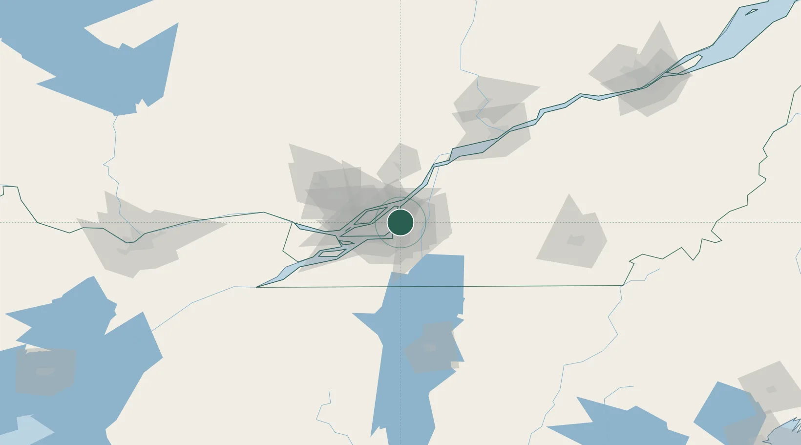
Nearby Logistics Neighbours

Cities
  1. 1Longue-Pointe6 km
  2. 2Saint-Hubert8 km
  3. 3Montréal-Est9 km
  4. 4Pointe-aux-Trembles10 km
  5. 5Saint-Lambert10 km
Nearest neighbours — logibook spatial index (haversine) over the source coordinates
Ports
  1. 1Montreal10 km
  2. 2Contrecour40 km
  3. 3Beauharnois44 km
  4. 4Vaudreuil49 km
  5. 5Oka Sur Le Lac51 km
Nearest neighbours — logibook spatial index (haversine) over the source coordinates
Trade Zones
  1. 1Greater Montreal Free Zone Center11 km
  2. 2FTZ No. 118 Ogdensburg188 km
  3. 3Québec City FTZ220 km
  4. 4FTZ No. 109 Watertown261 km
  5. 5FTZ No. 263 Auburn303 km
Nearest neighbours — logibook spatial index (haversine) over the source coordinates
DatabookThe Record of Consolidated Knowledge
Canada beyond logistics?
Browse databook

All Sources

LocationsUN/LOCODE
UN/LOCODE — free
LocationsGeoNames
CC BY 4.0
Portsthe NGA World Port Index
Public domain (US gov)
AirportsOurAirports
Public domain
Trade Zonesthe World Bank SEZ database
CC BY 4.0
Trade ZonesOpen Zone Map
CC BY
← Canada locations